Fencing (river)
| Fencing | ||
|
The catchment area of the fencing |
||
| Data | ||
| Water code | FR : A2-0100 | |
| location |
France
|
|
| River system | Rhine | |
| Drain over | Ill → Rhine → North Sea | |
| Headwaters | in the municipal area of Metzeral 47 ° 57 ′ 10 ″ N , 7 ° 1 ′ 58 ″ E |
|
| Source height | approx. 1240 m | |
| muzzle | at Illhaeusern in the Ill coordinates: 48 ° 10 ′ 58 " N , 7 ° 25 ′ 49" E 48 ° 10 ′ 58 " N , 7 ° 25 ′ 49" E |
|
| Mouth height | approx. 170 m | |
| Height difference | approx. 1070 m | |
| Bottom slope | approx. 22 ‰ | |
| length | 49.1 km | |
| Catchment area | 545.3 km² | |
| Drain at the mouth |
MQ |
6.94 m³ / s |
| Small towns | Muenster | |
|
Confluence of the Fecht (left) with the Kleine Fecht (right) in Munster (Haut-Rhin) |
||
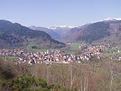
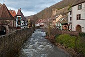
The Fecht is a 49 km long left tributary of the Ill in the Münstertal in the French department of Haut-Rhin . It drains in a northeastern direction.
geography
Spring streams
The official origin of the fencing, according to the French water database sandre.fr , is in the headwaters of the Große Fecht, between the Vosges peaks Lauchenkopf (1340 m) and Breitfirst (1280 m), in the municipality of Metzeral . From the town of Munster at the latest, the river is continuously called Fecht .
Great fencing

The Große Fecht , French Grande Fecht , arises from the confluence of the Schweiselrunz (1.8 km) and Salzbach northeast of the Schweiselwald . It has a length of about 13.7 km, a catchment area of 97.6 km² and a mean discharge (MQ) of 2.85 m³ / s.
The valley system of the Große Fecht ( Mittlacher Tal ) has been profiled by glaciers from the last ice ages in a typical trough valley shape.
- Tributaries of the Great Fecht
Pfahlrunz (left, 2.0 km), Troeselrunz (right, 2.6 km), Saurunz (right, 1.6 km), Kolbenfecht (left, 4.6 km), Giesenbachrunz (right), Wormsabachrunz (left, 4 , 1 km), Hoellenrunz ( right ), Braunbach ( left ), Fecht, Breitenbachrunz (right, 3.2 km), Furch (right, 5.2 km), Eschbach-Au-Val ( right )
Sondernacher fencing
The Fecht of the Sondernacher Valley rises east of the Fauchenkopf and joins the Große Fecht, which has hardly any water here, after a flow distance of 7.3 km near Metzeral. It has a catchment area of 26.0 km² and a mean discharge (MQ) of 0.7 m³ / s.
- Tributaries of the Sondernacher Fecht
Rodies (left), Langenfeldrunz (right), Storchenrunz (right), Oderbach (left), Landersbach (right)
Small fencing

The Kleine Fecht , French Petite Fecht , rises in several steep basins between the Hohneck and the Col de la Schlucht . It has a length of 11 km and flows together with the Große Fecht near the small town of Munster . It has a catchment area of 51.2 km² and a mean discharge (MQ) of 1.47 m³ / s.
- Tributaries of the Kleine Fecht
-
- Schluchtrunz (left source stream), Hundsmissbach (right source stream), Hellenrunzbach (right), Altenbach (right), Schweinbachrunz (left), Sattelrunz (right), Kleintalbach (left), Widenthalrunz (right), Langenbach (left), Walsbach (left )
course
The united fencing initially runs in an easterly direction. North of Soultzbach-les-Bains , the Krebsbach flows towards you on your right . The Fecht turns northeast and flows south past Wihr-au-Val . It runs past Walbach and Zimmerbach to the south and is fed by the streams of the same name on the left. Their course leads them in gentle curves towards Turckheim . There it is reinforced from the left by the Rotbach coming from the northwest . It passes the city, then the village of Ingersheim and then changes direction to the north. The Weiss , its largest tributary, flows east of Sigolsheim . The Fecht path now leads past Houssen to the left. The Sembach flows down the river, followed by the Lauenbach and Altenbach in Ostheim , and later the Strengbach in the direction of Guémar . The fencing runs south along Guémar and is fed there by the Lohbach and then by the Muehlbach . Then it turns east, takes in the Breitbrunnewater on its right side and finally flows into the Ill at Illhaeusern .
Near Turckheim, water is diverted for the irrigation of Colmar through the Canal du Logelbach, built in the 18th century .
Tributaries and branches
The Fecht tributaries include downstream, with orographic allocation , length information in km, catchment area size in km², mean discharge (MQ) in m³ / s :
- Heidenbach ( left ), 1.4 km
- Kalbach ( left ), 1.3 km
- Gunsbach ( left )
- Krebsbach ( right ), 9.1 km, 24.5 km², 0.31 m³ / s
- Walbach ( Winkelbach ) ( left )
- Zimmerbach ( left )
- Rotenbach ( left )
- Logelbach ( right junction )
- Weidbach ( left )
- Weiss ( left ), 24.3 km, 169.3 km², 0.47 m³ / s
- Sembach ( left ), 10.6 km
- Lauenbach ( left )
- Altenbach ( left ), 7.3 km
- Strengbach ( left ), 17.3 km, 39.6 km², 2.82 m³ / s
- Lohbach ( left )
- Muehlbach ( left ), 2.8 km
- Breitbrunnewasser ( right ), 5.5 km
Places on the river
Hydrology
At the confluence of the Fecht in the Ill , the mean flow rate (MQ) is 6.94 m³ / s; the catchment area here covers 545.3 km².
For the fencing at the Ostheim gauge , the average annual runoff was calculated over a period of 39 years (1972–2010). The catchment area of this point (447 km²) corresponds to about 82% of the total catchment area.
The flow rate fluctuates quite strongly over the course of the year. The highest water levels are measured between December and March. The flow rate reaches its peak in March at 12.00 m³ / s. The lowest level is reached in September with 2.04 m³ / s.
Data calculated from the values from 1972–2010

Web links
- Débits caractéristiques de la Fecht (French; PDF file; 23 kB)
- Carte des Vosges (22) Munster 1: 50,000 , (July 1929)
- Course of the fencing on SANDRE
Notes and individual references
- ↑ a b geoportail.fr (1: 16,000)
- ↑ Fencing at SANDRE (French)
- ↑ a b see web link: Débits caractéristiques de la Fecht
- ↑ Sondernach fencing
- ↑ probably falsely by SANDRE as rivière la grande fencing (A2000730) out
- ↑ Length information according to SANDRE or self- measurement on the Géportal , information on EZG and MQ according to Débits caractéristiques de la Fecht
- ↑ Empties into the Rhine
- ↑ Banque Hydro - A2052020 La Fecht à Ostheim (menu item: Synthèse)


