Hohneck
| Hohneck | ||
|---|---|---|
|
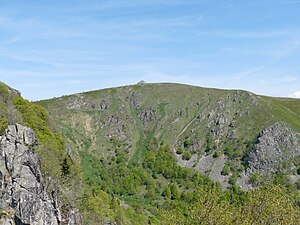
The falls of the Hohneck to the Wormspelkessel in the southeast |
||
| height | 1363 m | |
| location | Border of the Vosges / Haut-Rhin departments , France | |
| Mountains | Vosges | |
| Dominance | 15.54 km → Storkenkopf | |
| Notch height | 186 m ↓ dog's back | |
| Coordinates | 48 ° 2 '15 " N , 7 ° 0' 59" E | |
|
|
||
The Hohneck (also the Hohneck ) is 1363 meters high, after the Großer Belchen ( 1424 m ) and the Storkenkopf ( 1366 m ) the third highest mountain in the Vosges .
Location and characteristics
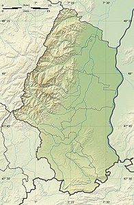
The Hohneck is located in the French region of Grand Est , on the border between Alsace and Lorraine and the departments of Vosges and Haut-Rhin . It is located in the Ballons des Vosges Regional Nature Park .
The mountain shows a clearly subalpine character; its rocky slopes exceed the usual dimensions for a low mountain range. In particular, the flanks that break off to the north, east and south offer spectacular impressions of the landscape which, especially in winter, can represent “alpine” dangers due to overhanging snow banks and avalanches .
The famous Vosges ridge road Route des Crêtes leads west around the mountain. From there a spur road branches off to the summit. The Hohneck is the highest point in the Vosges that can be reached by car.
fauna and Flora
Many high mountain plants thrive on its unforested slopes. Remains of Ice Age flora can also be found on the mountain meadows of the Hohneck . With a little luck you can watch chamois on the slopes of the Hohneck .
tourism
The Hohneck is a popular hiking destination with a panoramic view of the mountains of the High Vosges and of the Upper Rhine Plain , the Kaiserstuhl and the Black Forest in the east, the Swiss and French Alps in the south and the Lorraine plain to the west. The GR 5 long-distance hiking trail leads over its summit. There is a mountain inn with a restaurant and kiosk at the summit. At Petit Hohneck and the Col de la Schlucht are ski lifts. The couloirs on the north side, which can only be walked when there is snow, are a popular (training) destination for mountaineers and extreme skiers until spring. On the southern slope of the pre-summit to the north, separated from the main summit by the Col du Falimont ( 1306 m ), is the granite Martinswand, which is heavily frequented by climbers and is up to 80 meters high.
Individual evidence
- ↑ Dominances and celebrities according to Highrisepages.de ( Memento of the original from October 19, 2014 in the Internet Archive ) Info: The archive link was inserted automatically and has not yet been checked. Please check the original and archive link according to the instructions and then remove this notice.
- ↑ Geoportal of the French Ministry of Economic Affairs and the Ministry of Energy: Topographic map. IGN , 2018, accessed March 24, 2018 (French).


