
Fermanagh (District)
| Fermanagh District Ceantar Fhear Manach |
|
|---|---|
  |
|
| geography | |
| Traditional county |
County Fermanagh County Tyrone |
| surface | 1876 km² |
| Administrative headquarters | Enniskillen |
| ISO 3166-2 | GB-FER |
| Demographics | |
| population | 62,400 (2012) |
| density | 33 people / km² |
| Denominations |
Protestants 34.3% Catholics 54.9% |
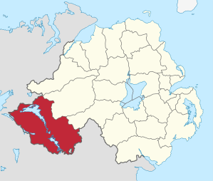
Fermanagh ( Irish Fear Manach ) was one of the 26 Northern Irish districts that existed from 1973 to 2015. The district comprised all of traditional Fermanagh and parts of traditional Tyrone . The administrative seat of the largest Northern Irish district in terms of area at this time was Enniskillen . Other places were Lisnaskea , Irvinestown , Belleek , Belcoo , Derrylin and Rosslea . Lough Erne took up one fifth of the district's area . On April 1, 2015, he went on in the new District Fermanagh and Omagh .
Fermanagh Council
The election to the Fermanagh Council on May 11, 2011 resulted in the following:
| Political party | 2011 result | Change from 2005 | |||
|---|---|---|---|---|---|
| Seats | be right | Seats | be right | ||
| Sinn Féin | 9 | 36.6% | 0 | −0.8% | |
| Ulster Unionist Party (UUP) | 6th | 24.0% | 1 | 1.9% | |
| Democratic Unionist Party (DUP) | 4th | 17.3% | 0 | −3.4% | |
| Social Democratic and Labor Party (SDLP) | 3 | 12.5% | −2 | −5.4% | |
| Traditional Unionist Voice | 0 | 1.0% | 0 | 1.0% | |
| Alliance Party | 0 | 0.4% | 0 | 0.4% | |
| Green party | 0 | 0.2% | 0 | −0.1% | |
| Independent | 1 | 7.3% | 1 | 6.9% | |
| Others | 0 | 0.8% | 0 | −0.5% | |
See also
Individual evidence
- ↑ Northern Ireland Population Estimates 2012 (XLS file)
- ↑ Northern Ireland Census 2011: Religion (administrative geographies)
- ^ Election result on BBC News (accessed July 26, 2011)
Antrim | Ards | Armagh | Ballymena | Ballymoney | Banbridge | Belfast | Carrickfergus | Castlereagh | Coleraine | Cookstown | Craigavon | Derry | Down | Dungannon and South Tyrone | Fermanagh | Larne | Limavady | Lisburn | Magherafelt | Moyle | Newry and Morne | Newtownabbey | North Down | Omagh | Strabane
Coordinates: 54 ° 20 ′ 47.5 " N , 7 ° 38 ′ 25.5" W.