Flöthe (river)
| Flute | ||
|
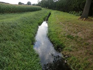
The Flöthe between Fiestel and the Mittelland Canal, around 2 km before the confluence with the Große Aue |
||
| Data | ||
| Water code | DE : 47614 | |
| location | District of Minden-Lübbecke , North Rhine-Westphalia ( Germany ) | |
| River system | Weser | |
| Drain over | Great Aue → Weser → North Sea | |
| source |
Wiehengebirge , Großes Torfmoor 52 ° 19 ′ 46 ″ N , 8 ° 40 ′ 25 ″ E |
|
| muzzle | in three different receiving waters, to the Große Aue , the Bastau and the Kleine Aue Coordinates: 52 ° 21 ′ 7 ″ N , 8 ° 33 ′ 28 ″ E 52 ° 21 ′ 7 ″ N , 8 ° 33 ′ 28 ″ E |
|
| Mouth height |
47 m above sea level NN
|
|
| length | 7.4 km | |
| Catchment area | 44.732 km² | |
| Left tributaries | Wittelsbach, Gehlenbecker Mühlenbach, Eickelmannsbach, Jägerbach, Hoffeldgraben, Ronceva , Blasheimer Bach | |
| Right tributaries | Westerbach , Stangenbach, Westerhaller Maschgraben, Gestringer Bach | |
| Medium-sized cities | Lübbecke , Espelkamp | |
| Small towns | Prussian Oldendorf | |
| Communities | Hille | |
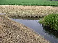
The Flöthe is a 7.4 km long, southeastern and orographically right tributary of the Great Aue . It flows in the East Westphalian district of Minden-Lübbecke in North Rhine-Westphalia mainly within the areas of the cities of Lübbecke and Espelkamp . Short sections of the river lie in the areas of the city of Preußisch Oldendorf and the municipality of Hille . The Flöthe has an unusual course and in a certain way represents a small river system, because it has two headwaters and three mouths.
The main spring area is in the area of the large peat bog near the Gehlenbeck outdoor pool . To the west of the moor it appears as an almost stagnant body of water, from there it flows on the one hand to the south and flows into the Bastau after around four kilometers, west of the small town of Husen , which belongs to the Lübbecke , with the confluence barely on the territory of the municipality of Hille lies, on the other hand, also to the north, forks and flows with the right branch after about one kilometer into the Kleine Aue and flows with the left branch after about ten kilometers, west of the Espelkamp village Fiestel into the Große Aue , where that mouth is very close in the area of the city of Preussisch Oldendorf. The latter branch crosses under the Mittelland Canal in an 80 m long culvert at the level of the Lübbeck industrial area . It then flows further almost to the mouth on the northern side parallel to this shipping route. This left, by far the longest branch, takes in several rivers downstream, including a. the Ronceva and further downstream a stream, also called Flöthe . The latter brook, or depending on the design, further branches, itself rises at the foot of the Wiehengebirge in the area of the settlements Vierlinden and Wettlage . The course of the Flöthe almost always has a very small difference in altitude, which also explains the unusual course: the headwaters at the Großer Torfmoor are 49 m above sea level. NN, all three mouths at 47 m above sea level. NN. The branch alone, which comes from the Wiehengebirge, lies in the upper reaches at around 120 m above sea level. NN. In addition to the moor mentioned, the catchment and drainage area also includes the wetland and nature reserve Rauhe Horst - Schäferwiesen .
use
The Flöthe is of local importance for sport fishing. Perch, roach and gudgeon can be fished.
Web links
Individual evidence
- Topographic map 1: 50,000, available via TIM-Online NRW
- ↑ a b c Water directory of the State Office for Nature, Environment and Consumer Protection NRW 2010 (XLS; 4.67 MB) ( Notes )
- ↑ Description of the fishing area on the Lübbecke sports fishing club website ( memento from January 2, 2016 in the Internet Archive )


