Fjord
A fjord is a usually narrow sea bay dug by a glacier tongue moving inland . Linguistically, Förde is the German and Fjord the Scandinavian variant of the same word. From a geological point of view, however, the fjords are not fjords , because the latter were created by glaciers moving seaward . On the east coast of the Cimbrian Peninsula same partially Baltic bays on Danish fjord and German Fjord called. The fjärdar on the Swedish and Finnish Baltic coasts are geologically neither fjords nor fjords.
Emergence
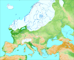
As a geological term, fjord and fjord are different, although both are glacial channels , i.e. valleys deepened by glaciers . While fjords were dug by mountain glaciers whose ice formed in high valleys ( Karen ) moved seaward , the fjords were dug by tongues of a large ice sheet that covered the basins of the Baltic Sea and Kattegat during the Vistula Ice Age about 20,000 to 70,000 years ago and whose ice covered itself moved inland on flat terrain . Therefore, they end up in a ground moraines - landscape . Due to this method of formation, the extensive absence of side valleys , especially hanging valleys , is typical for fjords .
list
- order from north to south -
Förden on the east coast of Jutland
- Langerak , 32 km long, eastern part of the Limfjord ; eastern entrance from Kattegat, western connection to the lagoon-like other parts of the Limfjord.
- Mariagerfjord , 35 km, flow channel 42 km long.
-
Randers Fjord , 30 km long, entrance from the north, branches out in the south in a T-shape.
- Grund Fjord , the eastern arm of the “crossbar” of the T, is less silted up than the inner part of Randers Fjord.
- Norsminde Fjord , only a little more than 3 km long, has been shortened by land reclamation since 1830 and the entrance to the inland lake with canalised sea access due to extensive siltation.
- Horsens Fjord , 16 km long; the entrance between the islands of Alrø and Hjarnø is called Alrø Sund .
- Vejle Fjord , 12 km long.
- Rands Fjord , only 3 km long, was still a fjord in the 19th century. After the entrance was blocked by a dam, it is now a freshwater reservoir.
- Kolding Fjord , 10 km long.
- Haderslev Fjord , 15 km long, narrower than the Schlei, very meandering.
- Aabenraa Fjord , 10 km long and 3 to 4 km wide.
- Als fjord , 12 km long, with Augustenborg Fjord even 20 km, wide entrance from the north and south of Als Sund as a narrow “back entrance”; Augustenborg Fjord is the name of the blind end east of Als Sound.
Förden (border and Germany)
There are four fjords and two former fjords in Schleswig-Holstein:
- The Flensburg Fjord is part of the German-Danish border. Depending on the definition, the length can be specified as 40 to 50 km.
- The Schlei is the narrowest (German) fjord and with a length of 40 to 42 km, depending on the type of measurement, can be regarded as the longest. Because of its narrow width, it is also believed that it was not dug by a glacier tongue, but that it was an ice age meltwater channel .
- The Eckernförde Bay (Danish: Egernførde Fjord ) is also one fashioned by glaciers - very wide - Fjord. The part of the name "förde" in the place name Eckernförde, however, probably stands for ford .
- The Kiel Fjord , which geologically includes part of the Kiel Bay .
- The former Hemmelsförde is now separated from the Lübeck Bay by a low strip of dunes as Hemmelsdorfer See .
- The former Traveförde, today partially silted up by sand deposits and separated from the Bay of Lübeck by the Priwall spit hook . The remainder, the mesohaline Pötenitzer Wiek , only has access to the Baltic Sea through the mouth of the Untertrave .
See also
literature
- Kurt-Dietmar Schmidtke: The emergence of Schleswig-Holstein . 3. Edition. Wachholtz, Neumünster 1995, ISBN 3-529-05316-3 .
Individual evidence
- ↑ Not every geographic bay is a bay according to international law. Legally, a bay needs a minimum width of 3.5 nautical miles and a minimum depth. Smaller bulges in the sea are called (natural) harbors. Cf. Erwin Beckert, Gerhard Breuer: Public Maritime Law. de Gruyter, Berlin / New York 1991, ISBN 3-11-009655-2 .
- ↑ What is disputed, however: according to some geologists, the deep channel of the Eckernförde Bay had already been created
- ↑ this ford lay between the city harbor and the Windebyer Noor within the city of Eckernförde; It is not clear whether Eckernförde was actually named after the ford or after the fjord

