Forstwerder
| Forstwerder | ||
|---|---|---|
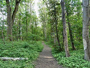
| Path on the Forstwerder | ||
| Waters | Saale | |
| Geographical location | 51 ° 30 ′ 55 " N , 11 ° 57 ′ 10" E | |
|
|
||
| length | 715 m | |
| width | 180 m | |
| surface | 8 ha | |
| Highest elevation | 75 m | |
| Residents | uninhabited | |
The Forstwerder , also Saalwerder, is a protected river island in the north of the city of Halle (Saale) . It belongs to the Trotha district .
Size and location
The island measures 715 meters in length in the direction of the river and is up to 180 meters wide. Their area is around eight hectares . The terrain height is on average around 75 m above sea level. NN. The lowest point ( 71 m above sea level ) in the urban area of Halle is on its bank .
The island is surrounded by the river basin flowing from south to north and a mill ditch on the right in its direction of flow. Between the two bodies of water there is the parallel channel of the Trotha lock (river kilometer 89.2), which divides the island lengthways into two parts, of which the left and larger part is forested.
The island lies in the high water area of the Saale. Its western bank (Stromsaale) is characterized by the natural dynamics of the river on the bank zone formation with gravel and mud banks as well as demolition edges.
natural reserve
The island is an integral part of the 11 hectare nature reserve of the same name (code NSG0185), which also includes a small river island west of the Forstwerder. This nature reserve is in turn part of the approximately 23 hectare FFH area " Nordspitze Peißnitz and Forstwerder in Halle".
The protection goal is the preservation of a valuable remnant of alluvial forest, also as a link in the biotope network along the river Saale. Particularly noteworthy parts of the vegetation are a larger hardwood forest with 150-200 year old oaks and ash trees and a larger occurrence of the wild tulip (Tulipa sylvestris) and the hairy teasel (Dipsacus pilosus).
The Forstwerder offers a species-rich avifauna favorable living and breeding conditions, e.g. B. for red kite , buzzard , black woodpecker , gray wagtail , tailed tit and bag tit , as well as various mammals, reptiles, snails and butterflies.
history
In the Middle Ages, the island belonged to the lords of the Trotha manor , who received it as a fiefdom in 1371 . In 1455 she came to the Neuwerk monastery . After its dissolution in 1530, it was subordinated to the Giebichenstein office. At that time, the Forstwerder served as a hunting ground, but also had extensive meadows, fruit trees and pastureland that were leased out.
Around 1790, the postmaster from Halle, Madeweis, had the intention of buying the island and converting it into an English garden, but this did not succeed. However, the island was discovered by the students of the university , founded in 1694 , who fought the strictly forbidden duels here or used it as an idyllic excursion destination, so that the area was also given the name " Elysium ".
The lock dividing the island was opened in 1694 by the Elector Friedrich III . built, was repeatedly renewed in the following decades, including in 1817. In 1873–1875 it was completely rebuilt for around 250,000 marks.
In 1927, a river bathing facility, Halle's first public outdoor pool, was opened on the river bank of the Forstwerder. For this reason, and also to replace an existing ferry connection, the island was given the Forstwerder Bridge in 1928, a bridge access for pedestrians in the form of a reinforced concrete arch with a span of 47 meters, which fits effectively into the landscape at the Trothaer weir.
literature
- Werner Piechocki : City Guide Halle (Saale) . Edited by City committee of the German Association for Hiking, Mountaineering and Orienteering of the GDR, Halle 1985, without ISBN. Pp. 73-74.
- Siegmar von Schultze-Galléra : Topography or history of houses and streets in the city of Halle ad Saale. Third volume (final volume): The incorporations of Giebichenstein, Trotha, Cröllwitz, Gimritz. Verlag Wilhelm Hendrichs, Halle 1924, reprint , Verlag Rockstuhl, Bad Langensalza 2018, ISBN 978-3-95966-308-3 , pp. 145–146.
Web links
Individual evidence
- ↑ Northern tip of the Peißnitz and Forstwerder in Halle , profiles of the Natura 2000 areas, Federal Agency for Nature Conservation . Retrieved October 26, 2019.
- ↑ Schultze-Galléra, p. 145 (see literature)


