Friedrichsfeld (Trendelburg)
|
Friedrichsfeld
City of Trendelburg
Coordinates: 51 ° 34 ′ 26 " N , 9 ° 27 ′ 42" E
|
|
|---|---|
| Height : | 211 m above sea level NHN |
| Area : | 2.9 km² |
| Residents : | 145 (December 31, 2018) |
| Population density : | 50 inhabitants / km² |
| Incorporation : | December 31, 1970 |
| Postal code : | 34388 |
Friedrichsfeld is a district of the city of Trendelburg in the northern Hessian district of Kassel .
geography
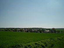
The small village of Friedrichsfeld is located on a hill on the edge of the Reinhardswald on a western slope between Gottsbüren and Trendelburg, the L763 road runs through the village; it is reminiscent of a street village . Little has been preserved from the original appearance of the village today. In the 19th century, individual farms and small residential buildings were built along the main street, among which a representative courtyard at the entrance to the village stands out. Not far away are the Saures Tal and Exen Hammelstall farms in the Feldmark .
For the cultural monuments of the place under monument protection see the list of cultural monuments in Friedrichsfeld (Trendelburg) .
history
Protestant settlers from the Limburg area asked the Prussian king for immigration permission in 1775. On their way they stopped in Kassel and received permission from Landgrave Friedrich II of Hessen-Kassel to settle in his country, which was devastated by the Seven Years' War . From 1776 a colony was established east of the city of Trendelburg, which was named after the landgrave.
On December 31, 1970 , as part of the regional reform in Hesse, the municipality of Deisel merged with six other previously independent municipalities and the small town of Trendelburg to form the expanded town of Trendelburg . They make up today's districts . The city administration is located in the core town of Trendelburg.
Honorary citizen
- 1895 Otto von Bismarck (1815–1898), Reich Chancellor
literature
- District Hofgeismar: Handbook of the Heimatbund for Kurhessen, Waldeck and Upper Hesse III . Marburg / Lahn 1966, p. 89
- Brigitte Warlich-Schenk & Emanuel Braun: Cultural monuments in Hesse, Kassel district. Part One; F. Vieweg & Sohn, Braunschweig / Wiesbaden 1988, ISBN 380-62-1619-3 , ISBN 978-3-80-621619-6
- Literature on Friedrichsfeld in the Hessian Bibliography
Individual evidence
- ^ Friedrichsfeld, District of Kassel. Historical local dictionary for Hessen. (As of November 6, 2019). In: Landesgeschichtliches Informationssystem Hessen (LAGIS).
- ↑ Statistics. In: Website hrsg = Stadt Trendelburg. Accessed August 2020 .
- ↑ Amalgamation of municipalities to form the town of Trendelburg, district of Hofgeismar on January 7, 1971 . In: The Hessian Minister of the Interior (ed.): State Gazette for the State of Hesse. 1971 No. 4 , p. 139 , point 157 ( online at the information system of the Hessian state parliament [PDF; 6.3 MB ]).
- ^ Federal Statistical Office (ed.): Historical municipality directory for the Federal Republic of Germany. Name, border and key number changes in municipalities, counties and administrative districts from May 27, 1970 to December 31, 1982 . W. Kohlhammer, Stuttgart / Mainz 1983, ISBN 3-17-003263-1 , p. 398 .
Web links
- The place on the website of the city of Trendelburg
- History of the place. In: www.grossberndt.de. Private website
- Friedrichsfeld, Kassel district. Historical local dictionary for Hessen. In: Landesgeschichtliches Informationssystem Hessen (LAGIS).

