Marbach (Mümling)
| Marbach | ||
|
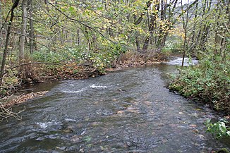
The Marbach below the Marbach reservoir |
||
| Data | ||
| Water code | DE : 24742 | |
| location | Hessen , Germany | |
| River system | Rhine | |
| Drain over | Mümling → Main → Rhine → North Sea | |
| origin | Confluence of the Streitbach and Güttersbach rivers 49 ° 37 ′ 21 ″ N , 8 ° 55 ′ 23 ″ E |
|
| Source height | approx. 290 m above sea level NN at the confluence | |
| muzzle | near Marbach in the Mümling coordinates: 49 ° 36 '27 " N , 8 ° 59' 22" E 49 ° 36 '27 " N , 8 ° 59' 22" E |
|
| Mouth height | approx. 260 m above sea level NN | |
| Height difference | approx. 30 m | |
| Bottom slope | approx. 5 ‰ | |
| length | 6 km from the confluence 12.5 km with Streitbach 15.5 km via Mossaubach |
|
| Catchment area | 57.38 km² | |
| Left tributaries | Mossaubach | |
| Reservoirs flowed through | Marbach reservoir | |
|
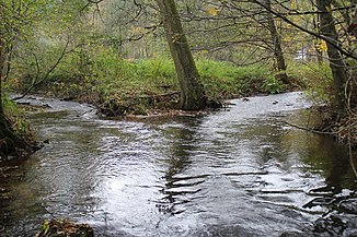
The Marbach (back right) flows into the Mümling |
||
The Marbach is a river in the Odenwald in Hesse . It arises in Hüttenthal from the confluence of the Streitbach and Güttersbach rivers, flows through the Marbach reservoir and flows into the Mümling from the left at Marbach . From a hydrological point of view, it forms the upper reaches of the Mümling, as it is significantly longer and richer in water at its mouth.
geography
Spring streams
Streitbach
The Streitbach rises southeast of Erzbach am Eselskopf (495 m). It flows in a southerly direction, crosses under the federal highway 460 ( Siegfriedstrasse ) and takes on the Schmerbach. Then it changes its direction of flow to the southeast and flows through Hiltersklingen . After the place the stream flows out of the Lindelbrunnen . At about 5.8 km, the Streitbach is the longer source stream.
Güttersbach
The source of the approximately 2.4 km long Güttersbach lies south of the village of Güttersbach . It flows north and takes on the Mornsbach and Mösselsbach. At Hüttenthal, the Güttersbach joins the Streitbach to form the Marbach.
course
After the confluence of the source brooks, the Marbach runs in a general south-east direction parallel to the federal highway 460 through Hüttenthal , where the roughly equal Mossaubach flows into it from the left. Shortly afterwards it reaches the Marbach reservoir . From here to the mouth it is border water between the cities of Erbach (district Haisterbach ) in the north and Oberzent (district Hetzbach ) in the south. Shortly after the lake, the stream passes the Haisterbach hamlet of Marbach on the left northern bank . About one kilometer down the valley from the dam, the Marbach crosses under the federal highway 45 and flows into the smaller and only 5.3 km long Mümling southwest of Ebersberg .
Tributaries
- Mossaubach (left)
- Bach from the Meisenbrunnen (right)


