Galapa (Colombia)
| Galapa | ||
|---|---|---|
|
Coordinates: 10 ° 54 ' N , 74 ° 53' W Galapa on the map of Colombia
|
||
|
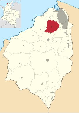
Location of Galapa in Atlántico
|
||
| Basic data | ||
| Country | Colombia | |
| Department | Atlántico | |
| City foundation | 1600 | |
| Residents | 43,896 (2016) | |
| - in the metropolitan area | 2,123,081 | |
| City insignia | ||
| Detailed data | ||
| surface | 98 km 2 | |
| Population density | 448 inhabitants / km 2 | |
| height | 83 m | |
| Time zone | UTC -5 | |
| City Presidency | José Fernando Vargas Muñoz (2016-2019) | |
| Website | ||
Galapa is a municipality ( municipio ) in the department of Atlántico in Colombia . Galapa is part of the Barranquilla Metropolitan Area , the metropolitan area of Barranquilla .
geography
Galapa is located in the sub-region Norte in Atlántico at an altitude of 83 m above sea level. NN , 8 km from Barranquilla and has an average annual temperature of 28 ° C. Galapa is near the Caribbean and the parish's terrain is mostly flat with only minor elevations. The municipality borders in the northeast on Barranquilla, in the east on Soledad , in the southeast on Malambo , in the south on Baranoa and in the west on Tubará .
population
The municipality of Galapa has 47,556 inhabitants, of which 43,223 live in the urban part (cabecera municipal) of the municipality. 2,123,081 people live in the metropolitan region (as of 2019).
history
Galapa is one of the oldest places in Atlántico. It existed as an indigenous settlement before the arrival of the Spaniards . The name Galapa goes back to an indigenous Kaziken . From 1600 the area was exploited by the Spaniards in the encomienda system . Galapa has had parish status since 1873.
economy
The main industries of Galapa are agriculture and cattle production . There are also handicrafts .
Web links
- Alcaldía de Galapa - Atlántico. Alcaldía de Galapa - Atlántico, accessed on May 15, 2019 (Spanish, website of the municipality of Galapa).
Individual evidence
- ^ Información del municipio. Alcaldía de Galapa - Atlántico, accessed on May 15, 2019 (Spanish, information on the geography of the municipality).
- ↑ ESTIMACIONES DE POBLACIÓN 1985 - 2005 Y PROYECCIONES DE POBLACIÓN 2005 - 2020 TOTAL DEPARTAMENTAL POR ÁREA. (Excel; 1.72 MB) DANE, May 11, 2011, accessed on May 15, 2019 (Spanish, extrapolation of the population of Colombia).
- ↑ Pasado, presente y futuro. Alcaldía de Galapa - Atlántico, accessed on May 15, 2019 (Spanish, information on the history of the municipality).
- ↑ Economía. Alcaldía de Galapa - Atlántico, accessed on May 15, 2019 (Spanish, information on the municipality's economy).


