Gammelgården (place)
| Gammelgården | ||||
|
||||
| State : | Sweden | |||
| Province (län): | Norrbotten County | |||
| Historical Province (landskap): | Norrbotten | |||
| Municipality : | Kalix | |||
| Coordinates : | 65 ° 53 ' N , 23 ° 2' E | |||
| SCB code : | 8578 | |||
| Status: | Crime scene | |||
| Residents : | 281 (December 31, 2015) | |||
| Area : | 0.65 km² | |||
| Population density : | 432 inhabitants / km² | |||
| List of perpetrators in Norrbotten County | ||||
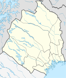
Gammelgården is a place ( Tatort ) in the Swedish province of Norrbotten County , in the historical province (landskap) Norrbotten .
Gammelgården belongs to the municipality of Kalix and within this, since January 1, 2016, to the district of Nederkalix, named after the parish (socken), which has been called this since 1644. It is located a good 50 km as the crow flies northeast of the provincial capital Luleå and 6 km northwest of Kalix , upstream on the left bank of the Kalixälven . At Gammelgården there are rapids with the islands of Åkerholmen and Syniholmen in the middle.
The secondary provincial road BD 721 runs through the village and follows the river bank. In Kalix and over a bridge about four kilometers above Gammelgården there is a connection to the European route 4 on the other bank ( Europaväg 4 ).
The place was first mentioned in 1505. Until the 19th century there were water-powered sawmills and mills there; ships were built in the 18th century.
Individual evidence
- ↑ a b Statistiska centralbyrån : Land area per Tatort, folkmängd and invånare per square kilometer. Vart femte år 1960 - 2015 (database query)
- ^ Local Utvecklingsplan. Gammelgården-bygden. Kalix kommun, Norrbotten County. on kalixbyar.se (Local Development Plan 2011, Swedish)
