Båtskärsnäs
| Båtskärsnäs | ||||
|
||||
| State : | Sweden | |||
| Province (län): | Norrbotten County | |||
| Historical Province (landskap): | Norrbotten | |||
| Municipality : | Kalix | |||
| Coordinates : | 65 ° 47 ' N , 23 ° 26' E | |||
| SCB code : | 8560 | |||
| Status: | Crime scene | |||
| Residents : | 227 (December 31, 2015) | |||
| Area : | 0.66 km² | |||
| Population density : | 344 inhabitants / km² | |||
| List of perpetrators in Norrbotten County | ||||
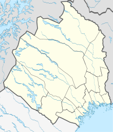
Båtskärsnäs ( Finnish Paaskeri ) is a place ( tätort ) in the Swedish province of Norrbotten , in the historical province (landskap) Norrbotten .

Båtskärsnäs belongs to the municipality of Kalix and within this, since January 1, 2016, to the district of Nederkalix, named after the parish (socken), which has been called this since 1644. It is about 60 km as the crow flies northeast of the provincial capital Luleå and 15 km southeast of Kalix . The place is located on the eastern side of the Bothnian the Baltic towering headland between the bays Repskärsfjärden / Vånafjärden and Kroksfjärden / Sangisfjärden, in the corresponding rivers Kalixälven and Sangis River flow.
Europastraße 4 ( Europaväg 4 ) runs a good five kilometers north of the town .
The village's wooden church and the associated bell stack were built in 1974 and 1976, respectively.
Web links
Individual evidence
- ↑ a b Statistiska centralbyrån : Land area per Tatort, folkmängd and invånare per square kilometer. Vart femte år 1960 - 2015 (database query)
