Garsdorf (Bedburg)
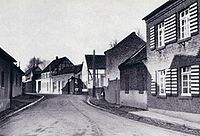
Garsdorf was a district of the city of Bedburg in the Bergheim (Erft) district in North Rhine-Westphalia . The place was relocated together with the neighboring towns of Frauweiler and Wiedenfeld in 1965 because of the Fortuna-Garsdorf open-cast lignite mine . Garsdorf and Frauweiler were added to the Bedburg town of Rath . The Wiedenfelder found their new home in Bergheim . In the last few years before the resettlement, Garsdorf had 360 inhabitants.
History of Garsdorf
Just like Frauweiler, Garsdorf appears for the first time in a church document in 1117. The place must have existed some time before. The earlier place names allow two conclusions about the meaning of the place name. On the one hand, “Geuestorp”, which means “Landdorf”, was mentioned several times. But the place was also mentioned under “Gersdorf”, which then allows conclusions to be drawn about the name Gerhard, ie “Gerhardsdorf”.
The area around Garsdorf must have been very rich in water, so many houses did not have a cellar, otherwise the excavation pit would have filled up. It was even said that in the past one would have come to Auenheim by ship from the Garsdorf castle pond. However, such a story is more likely to be accommodated in the area of legends and fairy tales. From a church perspective, Garsdorf has always been part of the parish of Auenheim . This also created a strong bond between the two places.

The first gentlemen from Garsdorf appear at the beginning of the 13th century. The castle in Garsdorf, which existed until around the 16th or 17th century, also came from this time. The lords of the castle in Garsdorf often changed due to death or marriage. The von Salm-Reifferscheid family is listed as the last ruling family over Garsdorf . With the French invasion , Garsdorf became part of the Office ( Mairie ) Bedburg .
Garsdorf has always been shaped by agriculture and developed into a center for craft and trade in the 19th century. There were ten different handicraft businesses, two inns and four shops with 280 inhabitants.
However, this structure quickly changed due to mining. The number of people employed in the mining industry rose by leaps and bounds. Garsdorf fared no differently than Frauweiler: The mining industry, which brought prosperity, took its toll, and so the Garsdorf residents had to leave their place by 1965 and move to Rath.
Reclamation
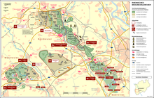
Today nothing can be seen of the Fortuna-Garsdorf opencast mine . A local recreation area was created here. On the Wiedenfelder Höhe and the recultivation area of the old opencast mine, a memorial plaque and crossroads remind of the relocated places and farms.
Today the themed street “Straße der Energie” leads across the recultivated area.
Web links
Coordinates: 51 ° 0 ′ N , 6 ° 38 ′ E


