Königshoven
|
Königshoven
City of Bedburg
|
|
|---|---|
| Coordinates: 51 ° 0 ′ 2 ″ N , 6 ° 32 ′ 46 ″ E | |
| Height : | 77 m above sea level NHN |
| Residents : | 1909 (Oct 31, 2015) |
| Incorporation : | 1st January 1975 |
| Postal code : | 50181 |
| Area code : | 02272 |
|
Location of the resettled as well as the former place Königshoven in the Rhenish lignite mining area
|
|

The place Königshoven is a district of the city Bedburg in the Rhein-Erft-Kreis in North Rhine-Westphalia . It was relocated to the vicinity of Kaster at the end of the 1970s because of the mining of lignite in the Rheinische Revier . The place is located in the triangle of cities Aachen - Düsseldorf - Cologne approx. 35 km northwest of Cologne.
history
First mention
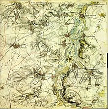
The name Königshoven was first used in a document from 1443. Königshoven originally consisted of four clearly delimited settlement cores that never fully grew together. Berke / at the end was at the highest, and Obermorken / Hovermorike was at the lower end. Separated by the Sothbach, the districts of Kynyncshoven / lowest village and Allhoven / Elrehoven were located below, although the spellings changed.
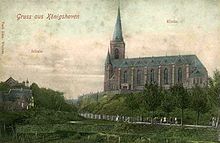
The oldest known documentary mention of a church in Obermorken / Hovermorikejenes, the district around the Königshovener Kirchberg, is dated April 8, 1272.
1945
On February 27, 1945, the time of National Socialism and the Second World War ended in Königshoven . In February 1945 the 11th Panzer Division of the Wehrmacht had brought large parts of their equipment into position near Grottenherten . Adolf Hitler had ordered the troops on the Rur to fight there instead of retreating behind the Rhine .
US troops advancing as part of Operation Grenade took grottoes under constant fire on the night of February 25-26, 1945 and captured it in the early morning of February 27th. Pütz and Königshoven were also captured after heavy artillery fire and chain bombs were dropped .
Relocation because of the lignite mining
Because of the large brown coal deposits that were under Königshoven (old), the place was relocated. About seven kilometers south of the old location, a new location was created, which was also called Königshoven.
In 1956, a declaration of liability was issued for the Frimmersdorf-Süd opencast mine with the determination of the resettlements of Darshoven, Epprath , Morken-Harff , Tollhaus and Königshoven.
In 1969/70 it was decided to move the new place to Kaster. Independence was insisted on. A citizens' meeting decided on a closed resettlement.
The groundbreaking ceremony took place in 1976 and the first houses were built. In 1978 the last Easter procession passed through old Königshoven. 1979 was the last service in the old church. In 1980 the new parish church was consecrated and the parish center opened. In 1980, with the opening of the house Hohenholz lying hamlet Hohenholz, the about 1 km from Königshoven distant relocation site of the farmers of Königshoven started. The rifle hut of the St. Sebastianus rifle brotherhood was also built there. The center of the village is the Catholic parish church of St. Peter with its parish center, designed by the architect L. Kösters from Cologne and consecrated in 1980.
The church treasure from three centuries and the rifle silver are owned by the parish. In 1981 the community hall on Josef-Schnitzler-Straße (former mayor of the Königshoven community and brother mayor ) was opened. With the inauguration of the village well on the village square in 1986, the relocation of the village was officially completed. The last resettler moved into his new house in 1987. Between 1997 and 2001, Königshoven was expanded to include the “Mühlenkreuz” development area.
Incorporation
On January 1, 1975, Königshoven was incorporated into the city of Bedburg (see Section 5 of the Cologne Law ).
politics
The local mayor is Wilhelm Moll ( CDU ).
Web links
- Gerhard Pankalla: The history and development of the parish church St. Peter and the place Königshoven
- St. Peter's Church
- Website of the city of Bedburg, district of Königshoven
- Website about Königshoven
Individual evidence
- ↑ http://bedburg.active-city.net/city_info/webaccessibility/index.cfm?region_id=336&waid=119&item_id=852073&link_id=213824133&fsize=1&contrast=0
- ↑ Kölner Stadtanzeiger February 22, 2005: The goal was the Erft
- ^ Federal Statistical Office (ed.): Historical municipality directory for the Federal Republic of Germany. Name, border and key number changes in municipalities, counties and administrative districts from May 27, 1970 to December 31, 1982 . W. Kohlhammer, Stuttgart / Mainz 1983, ISBN 3-17-003263-1 , p. 300 .
- ↑ Archived copy ( memento of the original from March 1, 2014 in the Internet Archive ) Info: The archive link was inserted automatically and has not yet been checked. Please check the original and archive link according to the instructions and then remove this notice. Info at bedburg.active-city.net


