
Garden
| Garden | ||
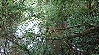
 The Garte flows into the Leine south of Göttingen |
||
| Data | ||
| location | District of Göttingen , Lower Saxony | |
| River system | Weser | |
| Drain over | Leine → Aller → Weser → North Sea | |
| source | In Weißenborn 51 ° 26 ′ 11 ″ N , 10 ° 8 ′ 18 ″ E |
|
| Source height | 303 m above sea level NN | |
| muzzle | South of Göttingen in the Leine Coordinates: 51 ° 30 '16 " N , 9 ° 55' 9" E 51 ° 30 '16 " N , 9 ° 55' 9" E |
|
| Mouth height | 152 m above sea level NN | |
| Height difference | 151 m | |
| Bottom slope | 6.6 ‰ | |
| length | 23 km | |
| Catchment area | 87.2 km² | |
| Left tributaries | Moosgrund, Bischhauser Bach | |
| Right tributaries | Glasehausener Bach, Bernsroder Bach, Bramke, Lengder Bach, Eichbach | |
The garden is a 23 km long, right or eastern tributary of the Leine in the district of Göttingen , southern Lower Saxony ( Germany ). It is a second order body of water.
geography

Garden spring in the middle of a meadow east of Weißenborn
Collection pond in the immediate vicinity of the source


The source of the garden is east of Weißenborn not far from the border with Thuringia . From here it first flows in a northerly direction. At the hamlet of Charlottenburg, the Glasehausener Bach coming from the southeast joins on the right . Here the course turns in a northwesterly direction, flowing through Beienrode (mouth of the Moosgrund ), Kerstlingerode , Rittmarshausen (mouth of the Bernsroder Bach ) and Wöllmarshausen . Here the course of the garden turns to the west. At Benniehausen , the garden on the left takes up the Bischhäuser Bach flowing from the south . A few kilometers downstream, the Bramke coming from the northeast , the Lengder Bach coming from the north and the Eichbach flow at Klein Lengden . About 2 km after flowing through Diemarden, the garden directs its course again to the northwest. East of Rosdorf and south of Göttingen , the garden joins the Leine coming from the south .
On its 23 km long path from the source to the mouth, the garden overcomes a height difference of 151 m. The average bed slope is 6.6 ‰.
Tributaries from the source to the mouth
- (unknown name, coming from Weißenborn) (L)
- Glasehauser Bach (R)
- Moosgrund (L)
- Bernsroder Bach (R)
- Bischhäuser Bach (L)
- Bramke (R)
- Lengder Bach (R)
- Eichbach (R)
literature
- H. Lücke: On the banks of the garden. Duderstadt 1927 (reprint Duderstadt 1989)
Individual evidence
- ^ Thuringian State Institute for the Environment (ed.): Area and waterway key figures (directory and map). Jena 1998. 26 pp.