Girzenberg
| Girzenberg | ||
|---|---|---|
|
Southern slope of the Girzenberg at its summit |
||
| height | 285 m above sea level A. | |
| location | Vienna , Austria | |
| Mountains | Vienna Woods | |
| Coordinates | 48 ° 11 '2 " N , 16 ° 16' 7" E | |
|
|
||
The Girzenberg is a 285-meter-high mountain in the 13th Vienna district , Hietzing .
geography
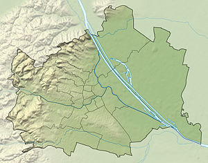
The Girzenberg is located in the western part of the built-up area of the Hietzing district in the Ober-St.-Veit district and, with two almost equally high hills, the Trazerberg 250 m northwest and the Rote Berg 400 m east , forms a contiguous, not of roads intersected green space.
The Lainzer Railway Tunnel, which was built in the 2000s and went into operation in December 2012, runs from northwest to southeast under the three mountains . The northern, eastern and southern slopes of the Girzenberg merge imperceptibly into the Rote Berg and form a local recreation area with it.
After the clearing of a large part of the forest areas and the surrounding area, the hill and its slopes were used for agriculture for centuries. B. as vineyards and pastures. The Girzenberg has been in Vienna's urban area since 1892; after the incorporation, the density of settlements around the three mountains has increased significantly.
Around the highest point of the hill and to the north and east of it there are forest and meadow areas, the western slope to Einsiedeleigasse and the southern slope to Veitingergasse were settled on the edge (Girzenberggasse, Flurgasse, Madjeragasse, Leon-Kellner-Weg).
Josef-Gangl-Gasse was once supposed to connect Girzenberg and Roten Berg on the southern slope, but was not completely expanded from either end. Instead of further single-family houses, there is a large meadow, the alley consists of a dead end on Girzenberg and one on the southern slope of the Red Mountain.
geology
The mountain is part of the Vienna Woods Mountains , the northeasternmost foothills of the Eastern Alps . Located on the eastern edge of the Lainzer Tiergarten , the Girzenberg is the base of the flysch zone (tectonically belongs to the North Penninic ), which is called the “Sankt Veiter cliff zone ” here . These are sediments of the Mesozoic Era (Upper Triassic to Lower Cretaceous ). Since the overlying flysch rocks severely crushed the cliff zone as they advanced north, the original sequence of layers ( stratigraphy ) is difficult to reconstruct. Various indicators (comparison with rocks occurring elsewhere, fossils ) suggest the following sequence (from old to young):
- Upper Triassic ( Rhät ):
- Coarse-grained reddish quartz - sandstone ( Keuper )
- Kössen formation (colorful fossil-bearing limestones )
- Lower Jura (Lias): sandy gray limestones ( Gresten Formation)
- Middle Jurassic ( Dogger ):
- Upper Jura ( Malm ):
- red (from hematite , eponymous for the neighboring red mountain ) and green silica limestone and radiolarite (Rotenberg Formation)
- white limes ( Aptychenkalk )
- lower chalk : white limestone (aptych limestone), they dominate the Girzenberg
With the rocks of the Rhät , the oldest rocks in the entire flysch zone occur on the Roten Berg and the nearby commune mountain .
Origin of name
The Girzenberg was first documented in 1819 in the French tax version . Walter Steinhauser derives the name from the old Slovenian gorica (little mountain). Also in Sankt Veit, a vineyard named Gorczer was named in 1493 and a Götzesperg in 1578 , but its location is not known and therefore cannot be unequivocally associated with the Girzenberg.
literature
- Margarete Platt: The field names in the 10th, 12th and 13th districts of Vienna and in Inzersdorf. Dissertation Vienna 1997
Web links
Individual evidence
- ^ Image archive Austria: Vienna 13, Glasauer Steinbruch
- ^ Walter Steinhauser: Slavic in Viennese. Vienna 1962. Notring Publishing House of the Austrian Scientific Associations.

