Roter Berg (Vienna)
| Red mountain | ||
|---|---|---|
|
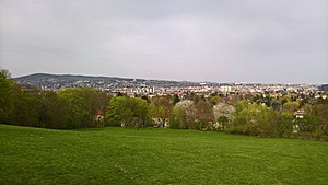
View from the Rote Berg towards Penzing |
||
| height | 262 m above sea level A. | |
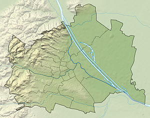
| location | Vienna , Austria | |
| Mountains | Vienna Woods | |
| Coordinates | 48 ° 10 '52 " N , 16 ° 16' 21" E | |
|
|
||
The Red Mountain is a 262-meter-high mountain in the 13th Vienna district , Hietzing .
Geography and geology

The Rote Berg is located in the south of the Ober-St.-Veit district on the border with the Lainz district . The little wooded hill, built only on the edge, forms a green space not crossed by roads with the negligibly higher hills Girzenberg and Trazerberg to the northwest . The Lainzer Tunnel , which was built in the 2000s and put into operation by the ÖBB at the end of 2012, runs from northwest to southeast under the three mountains (safety exit opposite Veitingergasse 59). In the depression east of the Red Mountain, the connecting railway between the western and southern railway and the piped Lainzerbach run in a north-south direction , then the terrain rises to the east to the Küniglberg .
Located on the eastern edge of the Lainzer Tiergarten , the base of the flysch zone (tectonically belongs to the North Penninic ) is to be found on the Rote Berg , which is called the " St. Veit cliff zone " here . These are sediments of the Mesozoic Era (Upper Triassic to Lower Cretaceous ). Since the overlying flysch rocks severely crushed the cliff zone as they advanced north, the original sequence of layers ( stratigraphy ) is difficult to reconstruct. Various indicators (comparison with rocks occurring elsewhere, fossils ) suggest the following sequence (from old to young):
- Upper Triassic ( Rhät ):
- Coarse-grained reddish quartz - sandstone ( Keuper ) (eg Nothartgasse. Gemeindeberg )
- Kössen formation (colorful fossil-bearing limestones )
- Lower Jura (Lias): sandy gray limestones ( Gresten Formation)
- Upper Jura ( Malm ):
- red (from hematite, eponymous for the red mountain) and green, sharp-edged breaking silica limestone and radiolarite (Rotenberg Formation, former quarry at today's safety exit of the Lainzer tunnel, opposite Veitingergasse 59)
- white limes ( Aptychenkalk )
- lower chalk : white limestone (aptych limestone)
With the rocks of the Rhät , the oldest rocks in the entire flysch zone occur on the Roten Berg and on the neighboring municipality mountain to the southwest .
history
The Rote Berg was first mentioned in a document in 1819. It got its name from the red earth, which has a high proportion of iron oxide . The name is relatively young and includes mostly the old vineyards (vineyards) Sommerhagenau and Mitterhagenau (the name of the vineyard is preserved in the lane In der Hagenau immediately south of the mountain).
The hill and its slopes were used for agriculture for centuries after a large part of the forest areas and the surrounding area were cleared. B. as vineyards and pastures. The Rote Berg has been located in Vienna's urban area since 1892 , in the 13th district. The densification of settlement in the surrounding parts of the district since incorporation made it a popular local recreation area, especially for Ober-St.-Veiter , Unter-St.-Veiter and Lainzer .
On May 1, 1981, SPÖ city councilor Heinz Nittel, who lived there, was murdered by an Arab terrorist on the slope of the Rote Berg at the corner of Nothartgasse and Bossigasse . Today the Heinz-Nittel-Weg, which crosses the eastern part of the green area, and a memorial plaque on the side of the path remind of him .
use
Large parts of the Red Mountain are a local recreation area with walking paths, a water playground and meadows for sports and games, including a toboggan slope. The top of the hill is forested, so that only the north and east slopes offer a limited panorama to the west, north and east. The next bus stops are on the eastern edge of the site on Gogolgasse (54B) as well as on Tolstojgasse and Veitingergasse (both: 54A, 54B).
Part of the green area of the Red Mountain (northwest of the Heinz-Nittel-Weg) is a dog run area.
A considerable part of the green areas on the Red Mountain are still privately owned today, although fences and boundaries are mostly missing.
Individual evidence
- ^ Image archive Austria: Vienna 13, Glasauer Steinbruch
- ↑ http://www.wien.gv.at/umwelt/parks/hundezonen.html#dreizehn
- ↑ [1] , note from 2015
literature
- Margarete Platt: The field names in the 10th, 12th and 13th districts of Vienna and in Inzersdorf . Dissertation Vienna 1997


