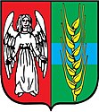
Gmina Gruta
| Gmina Gruta | ||
|---|---|---|

|
|
|
| Basic data | ||
| State : | Poland | |
| Voivodeship : | Kuyavian Pomeranian | |
| Powiat : | Grudziądzki | |
| Geographic location : | 53 ° 27 ' N , 18 ° 57' E | |
| Residents : | see Gmina | |
| Postal code : | 86-330 | |
| Telephone code : | (+48) 56 | |
| License plate : | CGR | |
| Economy and Transport | ||
| Rail route : | Jabłonowo Pomorskie – Grudziądz | |
| Gmina | ||
| Gminatype: | Rural community | |
| Gmina structure: | 17 school authorities | |
| Surface: | 123.77 km² | |
| Residents: | 6413 (Jun. 30, 2019) |
|
| Population density : | 52 inhabitants / km² | |
| Community number ( GUS ): | 0406022 | |
| Administration (as of 2018) | ||
| Wójt : | Waldemar Zbigniew Kurkowski | |
| Address: | 86-330 Mełno |
|
| Website : | gruta.pl | |
The Gmina Gruta is a rural community in the powiat Grudziądzki of the Kuyavian-Pomeranian Voivodeship in Poland . Their seat is the village of the same name ( German Grutta) with about 1300 inhabitants.
geography

The community is located in the former West Prussia , about seven kilometers east of Grudziądz (Graudenz) . It borders in the west on the rural community Grudziądz and in the east on the elongated Mełno (Melnosee, Meldensee) .
history
As part of the first partition of Poland in 1772, the municipality came to Prussia . In 1919 it became part of the re-established Poland and was occupied by Germans from 1939 to 1945 during World War II and assigned to the district of Graudenz in the Reichsgau Danzig-West Prussia . Before the end of the war, the area came back to Poland.
The rural community existed from 1934 to 1954 and was re-established in 1973. From 1975 to 1998 it was part of the Thorn Voivodeship .
structure
The rural community of Gruta includes 17 villages (German names until 1945) with a Schulzenamt:
- Annowo ( 1939–1942 Annaberg, 1942–1945 Annaberg, district of Graudenz)
- Boguszewo (Boguschau)
- Dąbrówka Królewska (Royal Dombrowken, 1942–1945 Königsdamerau)
- Gołębiewko (Pigeon Village)
- Gruta ( 1939–1942 Grutta, 1942–1945 Frankenhain)
- Jasiewo (Hansfeld, 1939–1945 Hansfelde)
- Kitnowo (Kittnau)
- Mełno (Melno, 1942–1945 Report)
- Nicwałd ( 1939–1945 Nitzwalde)
- Okonin (Okonin , 1942–1943 Ockonin, 1943–1945 Ockenin)
- Orle (Orle)
- Plemięta (plement)
- Pokrzywno (Castel Sant'Angelo)
- Salno ( 1939–1942 Sallno, 1942–1945 Sallnau)
- Słup ( 1939–1942 Slupp, 1942–1945 Starkenberg, district of Graudenz)
- Viktorovo (Viktorovo)
Other villages in the municipality are the settlement Słupski Młyn (Mill Slupp) and the forest settlement Karasek.
traffic
Mełno station and Boguszewo stop are on the Działdowo – Chojnice railway line . The Culmsee – Melno small railway also ended in the former .
Web links
Footnotes
- ↑ population. Size and Structure by Territorial Division. As of June 30, 2019. Główny Urząd Statystyczny (GUS) (PDF files; 0.99 MiB), accessed December 24, 2019 .
- ↑ The Historical Place Directory

