
Green Ring (Hanover Region)


The Green Ring is a circular, hiking and cycling path that was inaugurated in August 1998 and goes around the city of Hanover , roughly along the city limits . Its hallmarks are wooden posts, stones, fences and other waymarks that are painted in blue.
course
The Green Ring is ideal for exploring the various landscapes around the city of Hanover and the transition from the district to the outskirts and the surrounding area. It consists of a base ring 80 km in length. With the three surrounding loops to Garbsen, Sehnde / Laatzen and Ronnenberg / Gehrden, it has a length of 160 km. It also has two internal loops.
The basic loop leads - starting in the north of Hanover - through the districts (as well as independent communities or cities) Langenhagen , Isernhagen-Süd , Lahe , Misburg , Anderten , Bemerode , Laatzen , Hemmingen , Arnum , Devese , Wettbergen , Empelde , Benther Berg , Velber , Ahlem , Letter , Marienwerder , Garbsen , Vinnhorst and Godshorn .
Since the Green Ring crosses bodies of water in around 50 places, so-called watermarks were set up at 18 water crossings in 2013 . These are steles , water signs , water meters and water panels.
The labeling in rural areas is good enough. In the urban area, the information is very often missing. It is therefore advisable to have good maps or a navigation device with you.

Blue trail markings in Marienwerder
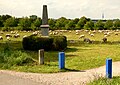
Path markings at the parade stone on the Kronsberg

Water point at the river crossing of the Fosse am Velberholz

Information on the leash on the “watermark” column in the Hinüberschen garden in the Marienwerder district of Hanover


,_Leine_bei_Marienwerder,_04b01c,_Informationstafel_zur_Leine_insbesondere_in_der_Region_Hannover.jpg)

Landscapes

The Green Ring connects several landscape areas. In the north, the Green Ring runs through the landscape of the North German Plain with Geest ( Hannoversche Moorgeest , Burgdorf-Peiner Geest ) and moors. In the south it leads through the Lössbörde ( Hildesheimer Börde , Calenberger Lössbörde ). In between runs the valley of the Leine .
See also
literature
- The green ring. Cycling map. Cycling in and around Hanover . Scale 1: 25,000. Ed .: Region Hannover, local recreation team, design team. 4th edition Hanover 2005.
- Booklet accompanying the 4th edition of the Green Ring cycling map. What, when, how, where. Cycling in and around Hanover . Ed .: Region Hannover, team local recreation. 3rd edition Hanover 2005.
- The green ring & natural bands. Measures for open space development in the landscape areas of Hanover. Implementation program 1998-2002 . State capital Hanover, Environment Department. Hanover: State capital Hanover, Environment Department 1998. (Series of publications on communal environmental protection. 19)
Web links
- The Green Ring - Official information of the Hanover region
- Main route of the Green Ring on OpenStreetMap on OpenStreetMap
- Google Earth Layer of the Green Ring - Google Earth Layer of the Green Ring
Individual evidence
- ^ On the Green Ring around Hanover , description of the North German Broadcasting Corporation
- ↑ watermark