Graafstroom
 flag |
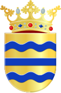
 coat of arms |
| province |
|
| local community | Molenlanden |
|
Area - land - water |
69.32 km 2 66.91 km 2 2.41 km 2 |
| Residents | 9,894 (Dec. 31, 2012) |
| Coordinates | 51 ° 53 ' N , 4 ° 48' E |
| Important traffic route |
|
| prefix | 0184 |
| Postcodes | 2922, 2952, 2954, 2961, 2964, 2967, 2969, 2971, 2973-2975, 2977, 3355-3356, 3361, 3364, 3366, 3373, 3381, 4225 |
Graafstroom ( ) was a municipality in the Dutch province of South Holland and, according to the CBS, had 9,894 inhabitants on December 31, 2012 . On January 1, 2013, she went on in the new community of Molenwaard . The total area of the municipality was 69.32 km² at the time of the dissolution. Your area has been part of the municipality of Molenlanden since January 1, 2019 .
places
There were seven villages in the municipality, namely:
- Bleskensgraaf including Hofwegen with 2788 inhabitants (as of January 1, 2008) is the seat of the municipal administration.
- Brandwijk , on the old canal called Graafstroom, 1212 inhabitants; the village has a donk , a small sand hill on which five old farms stand.
- Goudriaan , in the northeast of the municipality, 847 inhabitants.
- Molenaarsgraaf , opposite Brandwijk, 1086 inhabitants, location of the municipal works.
- Ottoland , 985 inhabitants.
- Oud-Alblas , on the western edge of the municipality, 2210 inhabitants.
- Wijngaarden or Wingerden, 697 inhabitants.
Location and economy
The somewhat remote community is located in the Alblasserwaard polder , and is crossed from west to east by an old canal called Graafstroom. Immediately southwest of the village of Oud-Alblas are the cities of Papendrecht and Dordrecht . Traveling by train and bus to this municipality is quite difficult. The next train station is in the southern neighboring municipality of Sliedrecht . There are only irregular buses from there. The nearest motorway connections are the A15 Arnheim - Tiel - Dordrecht , exit 24a Sliedrecht / Bleskensgraaf, as well as the A27 Utrecht - Breda , exit 25 Noordeloos, and then about 10 kilometers west on the N214.
Most of the residents of Graafstroom are farmers or commuters who work in the western conurbations around Rotterdam, Dordrecht, etc. There are two factories in the community that produce cheese and plastic items.
History and sights
Today's Graafstroom parish, which was named on the watercourse, was created in 1986 through a parish merger.
The individual villages are much older:
- As the residents claim, Oud-Alblas is said to have been drawn in under the name Tablis on the Peutinger map from the 4th century. In any case, this place was inhabited as early as the 8th century . The village has a church with a tower from the 14th century and several beautiful old farms.
- Bleskensgraaf owes its name to a local gentleman, Willem van Blassekijn, who administered the place in the 13th century. This was not insignificant, because he held the hoge jurisdictie (= high jurisdiction ). That meant that he could pronounce death sentences. The village was badly damaged during the Second World War by a German bombardment on May 12, 1940.
- Goudriaan and Molenaarsgraaf were first mentioned in 1260 and 1244, respectively, when the Bishop of Utrecht approved the construction of a church. In the Middle Ages, Goudriaan was administered by members of the famous Van Brederode family .
All of these villages have an old village church that is more or less worth seeing. The Dordrecht Tourist Office has put together cycling routes for this area.
gallery
politics
Distribution of seats in the municipal council
| Political party | Seats | |||
|---|---|---|---|---|
| 1998 | 2002 | 2006 | 2010 | |
| CDA | 4th | 4th | 4th | 4th |
| ChristenUnie | - | 2 | 3 | 3 |
| SGP | 3 | 3 | 2 | 2 |
| VVD | 2 | 2 | 2 | 2 |
| PvdA | 2 | 2 | 2 | 2 |
| RPF | 2 | - | - | - |
| total | 13 | 13 | 13 | 13 |
Web links
Individual evidence
- ↑ a b Bevolkingsontwikkeling; regio per maand Centraal Bureau voor de Statistiek , accessed on June 5, 2018 (Dutch)
- ↑ Allocation of seats in the municipal council: 1998–2002 2006 2010 , accessed on June 5, 2018 (Dutch)


