
Border between Latvia and Russia


.jpg)
The Latvia – Russia border is a 292 km long external border between the EU member Latvia and NATO and the CIS member Russia . A restricted border security zone is on the Russian side of the border. As a rule, the closed strip there is several kilometers wide, only sparsely populated and also includes extensive military restricted areas. A permit from the local FSB department is required to visit a location in this zone . Traffic to and from the border inspection posts is free. There is also a security lane on the Latvian side, which is indicated by signs on the road. Access is regulated, but not denied.
history
The Pskov Oblast ( Russian Псковская область Pskowskaja oblast ) and Latvia have been historically connected since the establishment of the Pskov Republic ( Russian Псковская Республика Pskowskaja Respublika ) in the 13th century. From 1925 to 1940, the Abrene County ( Abrenes apriņķis in Latvian ) was part of the Latvian Republic .
During the Second World War, the Soviet Union occupied the Republic of Latvia in 1940 and on August 23, 1944, illegally incorporated 1,075.31 km² of Latvian territory into the Soviet Union - the city of Abrene (now Пыталово / Pytalowo ) and six district communities (Purvmalas, Linava, Kacēnu, Upmales , Gauru and Augšpils pagasts). On January 16, 1945, the LSSR area was incorporated into the Russian Pskov Oblast and renamed Pytalowo Rajon . Since Latvia regained its independence, Latvia has claimed what was then sovereign territory on the basis of the Riga Treaty of 1921.
The definition of the borders with Russia was completed in 1998, but it was not until March 27, 2007 that the Latvian-Russian border agreement was signed. On September 23, 2009, a new demarcation came into effect, which was overseen by the Latvian-Russian Commission for Border Security. The meetings of the commission took place:
- from 23 to 24 September 2009 in Daugavpils ,
- from November 23 to 28 in Moscow,
- from 25th to 26th February 2010 in Jurmala ,
- from May 24th to 28th in Pskov and
- from September 21 to 23 in Riga.
The final fixation of the border didn't end until October 2017, when the final documents were signed. Accordingly, the Pytalowo district remains a part of Russia.
Borderline
The passage of the state border between the Russian Federation and the Republic of Latvia is determined on the basis of agreements. According to the agreement on the Russian-Latvian state border, the state border between Latvia and Russia begins at the triangle of Latvia, Russia and Belarus and ends at the triangle of Latvia, Russia and Estonia .
![]()
![]()
Latvia borders only on one administrative area of Russia: Pskov Oblast . Russia, on the other hand, borders on seven Latvian districts :
Crossing the border is officially only allowed at the border inspection posts. Most travelers require a visa on one or both sides of the border. Only non-citizens of Latvia are allowed to enter and leave the country without a visa .
|
|
⇄ |
|
position | ||
|---|---|---|---|---|---|
|
The triangle between Estonia , Latvia and Russia |
57 ° 31 '5 " N , 27 ° 21' 5" E | ||||
| RKP Pededze , Pededzes pagasts |
|
|
58K-339 | Bruniševa ( Russian Брунишево ) | 57 ° 32 '6.1 " N , 27 ° 28' 21.1" E |
| Bērziņi |
|
Manuhnova ( Russian Манухново ) | 57 ° 23 '46 " N , 27 ° 39' 48" E | ||
|
Katleši , Žīguru pagastā |
|
Untino ( Russian Унтино ) | 57 ° 20 '49.9 " N , 27 ° 46" 9.5 " E | ||
| RKP Vientuļi , Vecumu pagasts |
|
|
58K-530 |
MAP "Ludonka" , ( Russian МАПП «Лудонка» ) | 57 ° 8 '3.8 " N , 27 ° 46" 21.9 " E |
| Punduri , Baltinava district |
|
Punduri ( Russian Пундури ) | 56 ° 58 '17.2 " N , 27 ° 45' 4.2" E | ||
|
Kārsava , Kārsavas novads |
|
Skangaļi ( Russian Скангали ) | 56 ° 51 '11.9 " N , 27 ° 43' 42.5" E | ||
|
Grebņeva , Malnavas pagasts |
|
|
58K-306 |
Ubiļinka ( Russian Убылинка ) | 56 ° 52 '15.1 " N , 27 ° 49' 56.1" E |
|
Aizgārša , Goliševas pagasts |
|
Ļamoni ( Russian Лямоны ) | 56 ° 44 '45.2 " N , 27 ° 54' 50.9" E | ||
|
Opoļi , Latvijas robežsardze |
Barracks Latvian Border Guard Opoļu robežapsardzības nodaļa |
Mogili ( Russian Могили ), Sebesch Rajon , Pskov Oblast | 56 ° 23 '58.1 " N , 28 ° 10' 32.5" E | ||
|
Zilupe , Zilupe District |
|
Posiņi ( Russian Посинь ) | 56 ° 23 '19.2 " N , 28 ° 10' 21.4" E | ||
| Terehova , Zaļesjes pagasts |
|
|
Burački ( Russian Бурачки ) | 56 ° 21 '21.6 " N , 28 ° 11' 38.1" E | |
|
Latvia - Russia - Belarus tri-border region |
56 ° 10 ′ 13 ″ N , 28 ° 9 ′ 5 ″ E | ||||
You can also cross borders by plane. The only international airport in Latvia is Riga Airport , which offers flights to Moscow and Saint Petersburg , among others . Daugavpils Airport , Liepāja , Jūrmala-Tukuma and Ventspils Airports are also registered as border crossing points.
Remarks
-
↑ a b c d e f g Official border crossings:
- List of border crossing points in accordance with Article 2 (8) of Regulation (EC) No. 562/2006 of the European Parliament and of the Council of 15 March 2006 on a Community code for people crossing borders (Schengen Borders Code). In: JURION. October 13, 2006, retrieved on June 17, 2019 (see LATVIA - RUSSIAN FEDERATION): "Land borders: (1) Aizgārša-oniamoni (Лямоны), (2) Bērziņi-Manuhnova (Манухново), (3) Grebņeva-Uаbiллии (кыbņeva-Uаbiļлин) ), (4) Kārsava-Skangaļi (Скангали) (railway) , (5) Pededze-Bruniševa (Брунишево), (6) Punduri-Punduri (Пундури), (7) Terehova-Burački (Бурачки), Ludonka (Лудонка), (9) Zilupe-Posiņi (Посинь) (railway) "
- Robezas apsardziba un control. (PDF) p. 3 , accessed on June 17, 2019 (Latvian, border guards and controls (richly illustrated) ).
-
↑ Closed or blocked connections across the border are marked with . The list is also based on the publications of the Schengen Commission. Since Russia has not joined the border agreement, some crossings have only been set up by the Latvian side.

- ↑ The checkpoint, which was completely expanded in 2000, only exists on the Latvian side. It was officially opened, but never put into operation. On the Russian side there is a forest path with no continuous connection to the west and the remains of the border control post about 550 m from the border. Due to the Russian government decree N839-r (2009), this point was finally closed from August 1, 2009
- ↑ Was planned, but has not yet been implemented
-
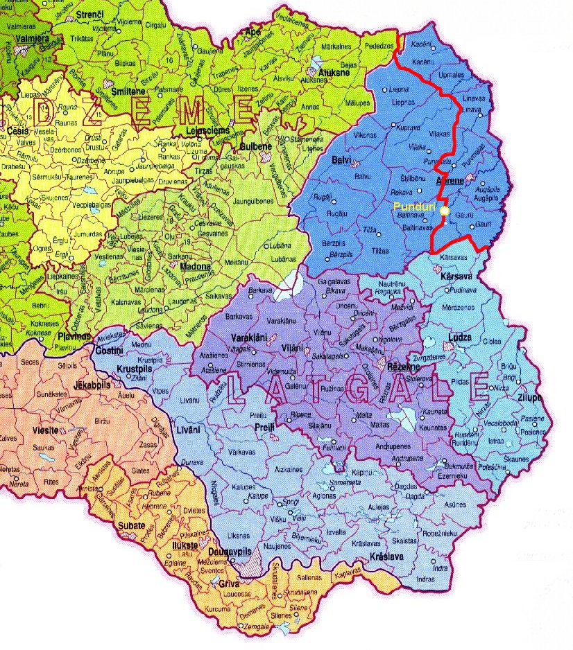
^ Closed train station, now on Russian territory in the immediate vicinity of the Latvian border. Opposite the former train station is the Latvian village of Punduri. On the Russian side only a residential building and a few commercial buildings of the railway remain. The former station building has collapsed. The Latvian-Russian border runs 30 meters west of the tracks of the railway line and runs entirely on Russian territory for a few kilometers along the border.
- станция Пондеры, Пундури, остановочный пункт Пундури. Pondera stop… pskovrail, 2019, accessed on June 5, 2019 (Russian, various photos).
- ↑ Railway connection Rēzekne - Pskov ( Saint Petersburg – Warsaw Railway )
- ↑ Visible with StreetView, but looks closed.
- ↑ Since 2002, only barracks and border posts
- ^ Line Rēzekne - Velikije Luki ( Moscow – Riga Railway, see Moscow Riga Railway Station )
See also
- List of borders in Europe
- Masļenki border incident
- Par Latvijas Republikas un Krievijas Federācijas līgumu par Latvijas un Krievijas valsts robežu. Agreement between the Republic of Latvia and the Russian Federation on the Latvian-Russian state border. In: LIKUMIL. November 30, 2007, accessed June 5, 2019 (Latvian).
- Arthur Gaveika: Eiropas savienības ārējo un iekšējo robežu rašanās tiesiskie priekšnosacījumi. Legal Principles Of The Creation Of The Internal And External Border Of The European Union. In: Sozialwissenschaftliches Magazin Nr. 1 (4) 113. Rēzeknes Tehnoloģiju akadēmija, 2012, accessed on June 17, 2019 (Latvian, External and Internal Boundaries of the European Union - Legal Conditions for Creation - Legal Principles of Creation of Internal and External Borders The European Union).
- Псковская Франция. Именно так в шутку называют Палкинский район Псковской области. Журнал "Новая Прагматика", May 2006, accessed on June 17, 2019 (Russian, Pskov France - this is how the Palkinsky district in the Pskov region is jokingly called.).
Individual evidence
-
^ Gesine Dornblüth: Russia and the Baltic States. War scenarios and small border traffic. Deutschlandfunk , May 10, 2018, accessed on June 17, 2019 : "Since Vladimir Putin reinforced his troops on the border with the Baltic countries, NATO has also increased its presence. The Estonians, Latvians, Lithuanians and Poles in particular suffer from the military threatening gestures. Private or business relationships across borders are becoming more difficult. ” Christina Hebel, Matthias Gebauer: Major maneuvers in Moscow and Minsk. War of nerves at the NATO border. Spiegel Online , September 14, 2017, accessed on June 17, 2019 : “Russian and Belarusian troops are starting a major maneuver near the NATO border. Minsk and Moscow claim that the exercise is purely defensive. Poland, the Baltic States and NATO doubt it. "
- ↑ Приказ ФСБ РФ от 2 июня 2006 года N 242 "О пределах пограничной зоны на территории Псковской области". German Resolution of the Federal Security Service of the Russian Federation of June 2, 2006 No. 242 “At the borders of the border zone on the territory of the Pskov region” . In: Путеводитель по России. Rossiyskaya Gazeta , December 4, 2011, accessed May 26, 2019 (Russian, registered by the Russian Ministry of Justice on July 4, 2006 - registration N 8009).
- ↑ Янин В. Л. Административное устройство Псковской земли // Новгород и Литва. Пограничные ситуации XIII — XV веков. - М., 1998
- ↑ Judīte Čunka et al .: Paraksta Latvijas un Krievijas robežu demarkācijas gala dokumentus. German Final documents of the Latvian-Russian border definition have been signed . LSM.lv, October 25, 2017, accessed on May 27, 2019 (Latvian).
- ↑ Map of Eastern Latvia. (Graphic) geosite.jankrogh.com, 2019, accessed May 26, 2019 .
- ↑ Договор между Российской Федерацией и Латвийской республикой о российско-латвийской государственой 2007. German Treaty between the Russian Federation and the Republic of Latvia on the Russian-Latvian state border of March 27, 2007 . (No longer available online.) In: Закон России. March 27, 2007, archived from the original on March 18, 2017 ; Retrieved May 27, 2019 (Russian). Info: The archive link was inserted automatically and has not yet been checked. Please check the original and archive link according to the instructions and then remove this notice.
- ↑ Par Latvijas Republikas un Krievijas Federācijas līgumu par Latvijas un Krievijas valsts robežu. German Agreement between the Republic of Latvia and the Russian Federation on the Latvian-Russian state border . Likumi.lv, March 27, 2007, accessed May 27, 2019 (Latvian).
- ↑ a b Notices and Announcements. C 126, 58th year. In: Official Journal of the European Union. April 18, 2015, accessed May 26, 2019 .
- ↑ Открыт новый МАПП «Лудонка». Федеральная таможенная служба, November 11, 2010, accessed on June 17, 2019 (Russian, German The new “Ludonka” MAP opens ).