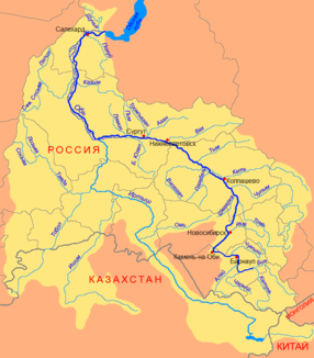
Great Jugan
|
Big Jugan Большой Юган (Bolshoi Jugan) |
||
|
Course of the Great Jugan (Большой Юган) as the left tributary of the Ob |
||
| Data | ||
| Water code | RU : 13011100212115200047130 | |
| location | Khanty-Mansi Autonomous Okrug ( Russia ) | |
| River system | If | |
| Drain over | Whether → Arctic Ocean | |
| source |
Wassjuganje 58 ° 41 ′ 44 " N , 75 ° 7 ′ 7" E |
|
| Source height | 120 m | |
| muzzle | in the Ob coordinates: 61 ° 4 ′ 0 ″ N , 73 ° 10 ′ 19 ″ E 61 ° 4 ′ 0 ″ N , 73 ° 10 ′ 19 ″ E |
|
| Mouth height | 26 m | |
| Height difference | 94 m | |
| Bottom slope | 0.09 ‰ | |
| length | 1063 km | |
| Catchment area | 34,700 km² | |
| Discharge at the Ugut A Eo gauge : 22,100 km² Location: 166 km above the estuary |
MQ 1945/1994 Mq 1945/1994 |
143 m³ / s 6.5 l / (s km²) |
| Discharge at the gauge Yugan Pzu A Eo : 33,000 km² Location: 118 km above the mouth |
MQ 1963/1973 Mq 1963/1973 |
178 m³ / s 5.4 l / (s km²) |
| Outflow location: 50 km above the mouth |
MNQ MQ MHQ |
29 m³ / s 205 m³ / s 615 m³ / s |
| Right tributaries | Little Jugan | |
| Navigable | Middle and lower reaches | |
|
Lower reaches of the Great Jugan above Ugut |
||
The Great Jugan ( Russian Большой Юган (Bolshoi Jugan)) is a 1063 km long left tributary of the Ob in Western Siberia ( Russia ).
course
The Great Jugan arises in the swamps of the Wassjuganje in the southern central part of the West Siberian lowlands from several small source streams. It then flows through the flat taiga area, primarily in northern directions, mostly in a strongly meandering, sparsely populated area on the central section to the west , up to its confluence with the left arm of the Yuganskaya Ob des Ob, just under two kilometers above the crossing of the Ob arm by the Tyumen railway line - Surgut - Novy Urengoy or - Nizhnevartovsk . Already above the river is connected to the arms of the Ob via narrow tributaries (Signei, Tuchta, Entlkussan).
The Great Jugan has its source in the immediate vicinity of the border with the Tomsk and Tyumen oblasts and then flows along its entire length through the southeastern part of the Khanty and Mansi Autonomous Okrug .
Hydrography
The catchment area of the Great Jugan covers 34,700 km². The mean monthly water flow is about 50 kilometers above the estuary 205 m³ / s (minimum in March with 29 m³ / s; maximum during the snowmelt in May with 615 m³ / s).
Near the mouth, the river is almost 200 meters wide and over two meters deep; its flow velocity is 0.4 m / s.
The most important tributary is the Little Jugan (Maly Jugan) from the right. In the catchment area of the river there are over 8000 lakes with a total area of 542 km².
The Great Jugan freezes from October / November to late April / early May.
Infrastructure
Along the river there are a number of small settlements from the middle reaches, but there is almost no transport infrastructure. About 75 kilometers southeast of the river mouth (as the crow flies) is Ugut, the most important settlement on the river. It emerged in the last decades as a workers' settlement in connection with the development of the West Siberian oil and gas fields . This is also where the only road crosses the river. The lower reaches of the Great Jugan is also crossed by several oil and gas pipelines (including from the direction of Nizhnevartovsk).
The Great Jugan is navigable in the lower middle and lower reaches for several hundred kilometers (to the Kuplandejewy pier ), but is hardly used.
Individual evidence
- ↑ a b Article Great Jugan in the Great Soviet Encyclopedia (BSE) , 3rd edition 1969–1978 (Russian)
- ↑ a b Great Jugan in the State Water Register of the Russian Federation (Russian)
- ↑ Großer Jugan at the Ugut gauge - hydrographic data at R-ArcticNET
- ↑ Großer Jugan at the Yugan Pzu gauge - hydrographic data from R-ArcticNET

