Gustedt (Elbe)
|
Gustedt
Elbe municipality
Coordinates: 52 ° 5 ′ 38 ″ N , 10 ° 18 ′ 12 ″ E
|
|
|---|---|
| Height : | approx. 130 m above sea level NN |
| Residents : | 740 |
| Incorporation : | March 1, 1974 |
| Postal code : | 38274 |
| Area code : | 05345 |
|
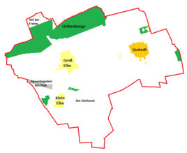
Location of Gustedt in the Elbe municipality
|
|
|
Christ Church
|
|
Gustedt is a district of the Elbe municipality, which is part of the Baddeckestedt municipality in the Wolfenbüttel district in Lower Saxony.
geography
The following places surround Gustedt:
- Lichtenberg and Altenhagen in the north
- Salder in the northeast
- Gebhardshagen in the east
- Steinlah in the southeast
- Ringelheim in the south
- Klein Elbe and Heere in the southwest
- Groß Elbe and Baddeckestedt in the west
- Osterlinde in the northwest
Gustedt is located southeast of the Lichtenberge, the northwest part of the Salzgitter ridge and about three kilometers west of the Reihersee .
history
The oldest evidence of settlement is a clay jug dating from 2000 to 1000 BC. Should come from.
Between 802 and 817 Gustedt was first mentioned in a deed of donation from a Fulda abbot.
Initially, the Ringelheim and Derneburg monasteries and the resident noble family von Gustedt owned land in the village. The latter owned the salt in Salzgitter and was considered wealthy, which explains a visit by Emperor Heinrich II in 1019. At the end of the 13th century the aristocratic family emigrated to the cities; The court was expanded into a fortification by the von Wallmoden family , but had to be demolished shortly afterwards at the insistence of the otherwise hostile rulers, Bishop Otto von Hildesheim and Prince Heinrich von Braunschweig.
In the Thirty Years' War 1618-1648 Gustedt was badly damaged. In 1789 and 1870, major fires also destroyed several buildings in the village.
Until 1815 Gustedt belonged to constantly changing domains before it finally fell to the Kingdom of Hanover .
From the beginning of the 20th century, agriculture lost more and more importance due to mechanization and modernization, so that Gustedt gradually developed into a residential community with commuters who worked in industry and from 1939 also in the nearby ore mining. After the end of the war, population growth led to the development of ever new residential areas, mainly through displaced persons.
On May 10, 1908, the Gustedt volunteer fire brigade was founded.
With the incorporation to Elbe in 1974, the primary school established in 1670 was converted into a kindergarten that still exists today.
church
A Protestant church today has existed in Gustedt since at least 1326. A building in 1291 seems possible. Today's church probably dates from 1420. At least this year there was a partial new building. The age of the tower is considered unknown.
The church was last renovated in 1977. The altar from the end of the 18th century was removed. The organ from 1864 is still preserved today.
The previously nameless church has been called Christ Church since June 23, 1989.
Since 1542 only one pastor has been responsible for the churches in Groß Elbe and Klein Elbe. In the meantime, the parish of Gustedt has formed a joint parish association with Groß Elbe and Klein Elbe.
Population development
| year | Residents |
|---|---|
| 1539 | 166 |
| 1815 | 296 |
Economy and Infrastructure
Transport links
Gustedt is located on Landesstraße 670, which connects Baddeckestedt, Groß Elbe and Bundesstraße 6 in the west with Gebhardshagen in the east.
The closest train stations are in Baddeckestedt on the Hildesheim – Goslar line and in Salzgitter- Lebenstedt on the Braunschweig – Salzgitter-Lebenstedt line .
Individual evidence
- ^ Portrait of Gustedt on the website of the Samtgemeinde Baddeckestedt , accessed on April 21, 2017.
- ^ Samtgemeinde Baddeckestedt (ed.): 25 years of the Samtgemeinde Baddeckestedt - 1974–1999. Festschrift ; 1999 (p. 25).
swell
- To the history section : Website of the municipality of Baddeckestedt (short chronicle)
- To the Church section : PDF file on the history of the church in Gustedt


