
Hagneck Canal
| Hagneck Canal | ||
 Map of the area after the construction of the canal |
||
| Data | ||
| Water code | CH : 37 | |
| location | Canton of Bern ; Switzerland | |
| River system | Rhine | |
| Drain over | Aare → Rhine → North Sea | |
| Beginning | near Aarberg 47 ° 2 ′ 9 ″ N , 7 ° 16 ′ 23 ″ E |
|
| Source height | approx. 451 m above sea level M. | |
| muzzle | at Hagneck in the Bielersee Coordinates: 47 ° 3 '43 " N , 7 ° 10' 38" E ; CH1903: 580 143 / 212 364 47 ° 3 '43 " N , 7 ° 10' 38" O |
|
| Mouth height | 429 m above sea level M. | |
| Height difference | approx. 22 m | |
| Bottom slope | approx. 2.8 ‰ | |
| length | 8 kilometers | |
| Left tributaries | Underwater channel | |
| Communities | Aarberg , Bargen , Walperswil , Täuffelen , Hagneck | |
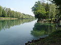
 Canal at the confluence with Lake Biel (upper water of the Hagneck barrage) |
||
The Hagneck Canal is an eight-kilometer connection between the Aare near Aarberg and Lake Biel in Switzerland .
Through it, the Aare is led into Lake Biel, which serves as a catchment basin for the sediment carried along . Lake Biel and the two other Jura lakes connected to it ( Lake Murten and Lake Neuchâtel ) have a balancing effect on the floods carried by the Aare. The Aare water flows together with that of Lake Biel through the Nidau-Büren Canal back into the old bed near Büren . The old course of the Aare between Aarberg and Büren is known as the Alte Aare .
The canal was built between 1875 and 1878 as part of the first Jura water correction . The ideas and planning of the canal came from the Graubünden engineer Richard La Nicca . The first water flowed into Lake Biel on August 16, 1878.
At the beginning of the canal is the Aarberg hydropower plant , which was built in 1963, and the Kallnach Canal joins halfway to Lake Biel, which carries the underwater of the Kallnach hydropower plant , which was commissioned in 1913 . At the confluence of the Hagneck Canal in Lake Biel, the Hagneck hydropower plant was built in 1900 , which uses the nine meters difference in altitude to generate electricity.
The canal was excavated without machines. The piercing of the Seerücken with a depth of 34 meters was particularly labor-intensive. Parts of an older tunnel from Roman times were uncovered, the remains of which were destroyed by the construction. This 180 meter long tunnel was used for the drainage of the Grosse Moos.
The excavation volume of the canal was 3.8 million cubic meters. Of this, only 1.6 million cubic meters were excavated mechanically and used for the embankments. The remaining volume was washed away by the Aare water in the following years and deposited in Lake Biel.

Beginning of the canal at Aarberg (underwater of the Aarberg Aare barrage)
Canal at the confluence (right) of the underwater from the Kallnach power plant

Map of the power plants on the Aare between Bern and Lake Biel


