Harkenbäk
| Harkenbäk (Harkenbeck, Harkenbeek) | ||
|
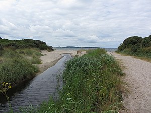
Harkenbäk estuary in the Baltic Sea near Barendorf |
||
| Data | ||
| Water code | DE : 96312 | |
| location | Germany , Mecklenburg-Western Pomerania | |
| River system | Harkenbäk | |
| source | in the Dassow district of Wieschendorf 53 ° 55 ′ 53 ″ N , 10 ° 58 ′ 2 ″ E |
|
| Source height | approx. 51 m | |
| muzzle | north-west of the Dassow district of Barendorf in the Baltic Sea coordinates: 53 ° 58 ′ 25 ″ N , 10 ° 57 ′ 2 ″ E 53 ° 58 ′ 25 ″ N , 10 ° 57 ′ 2 ″ E |
|
| Height difference | approx. 51 m | |
| Bottom slope | approx. 8.5 ‰ | |
| length | 6 km | |
| Right tributaries | Katzbach | |
| Flowing lakes | Deipsee | |
The Harkenbäk (also Harkenbeck or Harkenbeek ) is a flowing water in the Klützer Winkel .
The Harkenbäk rises west of the Schippmannsberg between the city of Dassow and its district of Pötenitz in the district of Northwest Mecklenburg . The Harkenbäk flows through the Deipsee at the shore on, Schlossberg at the spatial location Feldhusen a wendische ring wall , the rake Wall , and a passage grave located. It forms a pronounced river valley and flows north-west of Harkensee into the Lübeck Bay of the Baltic Sea .
Your mouth defined since Barbarossa privilege from the year 1188, the outer limit of the harbor of Travemünde . It was disputed from 1188 until a decision by the State Court of Justice for the German Empire in the Lübeck Bay case in 1928 and is formed by an imaginary line that runs from the mouth to the Gömnitzer Tower in Ostholstein .
The Harkenbäk lowland, which was created as a glacial channel during the Ice Age , was muddy and temporarily flooded, and was mainly used as grassland in the 18th century. The basin was drained in the 19th century with the construction of trenches. The Harkenbäk was expanded in the 1960s and 70s, the estuary relocated and the old drainage system partially destroyed in the process.
The Harkenbäk and its flood plain are completely protected in the nature reserve coastline between Priwall and Barendorf with Harkenbäkniederung . This nature reserve is 580 hectares in size and also secures the northern shore of the Dassower See , starting at the mouth of the Stepenitz , the eastern shore of the Pötenitzer Wiek and the coastal strip on the Lübeck Bay to Groß Schwansee . In the area of the banks of the Pötenitzer Wiek, the area was used for military purposes by the Pötenitz Aircraft Office during World War II. In the coastal forest there are therefore still various remains of buildings from this time. At the Priwall it includes the northern end of the German Green Belt . The Deipsee was placed under protection as early as 1938.
Individual evidence
- ^ Ministry of Environment Mecklenburg-Western Pomerania (ed.): The nature reserves in Mecklenburg-Western Pomerania , Demmler Verlag, Schwerin 2003, ISBN 3-910150-52-7 , p. 56
literature
- Friedrich Schlie : The art and history monuments of the Grand Duchy of Mecklenburg-Schwerin. Volume II: The district court districts of Wismar, Grevesmühlen, Rehna, Gadebusch and Schwerin. Schwerin 1898, Neudruck Schwerin 1992, p. 419 ff., (420). ISBN 3-910179-06-1
- Werner Strecker: Final report on the situation of the Travemünder roadstead in: Yearbook of the Association for Mecklenburg History and Archeology, Vol. 92, Schwerin 1928, pp. 173-200 ( digitized version )
Web links
- Nature reserve ordinance of January 5, 2000 (GVOBl. MV 2000, p. 47).
