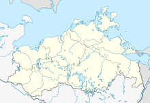
Coastal landscape nature reserve between Priwall and Barendorf with Harkenbäkniederung
Coordinates: 53 ° 57 '53.3 " N , 10 ° 57' 3.2" E

The coastal landscape nature reserve between Priwall and Barendorf with Harkenbäkniederung is a 580 hectare diverse nature reserve in Mecklenburg-Western Pomerania north of Dassow . It borders in the west on the Pötenitzer Wiek and the Priwall peninsula , in the north on the Baltic Sea and includes a coastal lowland with dunes and beach ridges, cliff coast, an unobstructed incised brook - the Harkenbäk - as well as moors and small lakes. On March 2, 1938, protection was initially only granted for the Deipses area. The area was expanded by further regulations in 1990, 1992 and 2000.
The current state of the area is assessed as good. The Naturschutzbund Deutschland Mecklenburg-Vorpommern looks after the protected area. There are several ways to enter the protected area. On the former Kolonnenweg there is a cycle and hiking trail along the Baltic Sea coast.
history
Today's protected area consists of three differently created parts: The Pötenitz beach meadows go back to beach ridges that were formed after the Ice Age and cut off the area near Pötenitz from the open Baltic Sea. The moraine cliffs can be traced back to glacial till upheavals during the Ice Age. The Harkenbäkniederung also emerged from the Ice Age as a tunnel valley lying under the glacial ice, which silted up and mossed up after the ice had melted.
A grassland use for the Pötenitzer beach meadows and the Harkenbäkniederung has been proven for centuries. However, rare species such as marsh orchid , bitter gentian and lung gentian disappeared after extensive drainage work and the construction of a pumping station . The areas sagged due to the drainage and are now in places below sea level. Agricultural use is also documented.
From 1961, the areas were isolated on the inner-German border . A column route of the GDR border troops led through the area.
Flora and fauna
There are various beach ridges with salt-loving vegetation adjacent to the Baltic Sea. Typical representatives are chickweed , beach grass , beach rye , potash brine , red fescue , sea buckthorn , bedstraw , pimpinelle , sand sedge , silver grass and sea mustard .
The western part of the protected area is made up of moist grasslands and swamp forest with swamp sedge , iris , alder , grass clown , water canary and willows .
The area of the Harkenbäk is occupied by quarry forest and reed beds.
In the far east of the protected area there are abandoned wet grasslands with reeds near Barendorf.
The breeding birds in the area are the carmill , the sparrowhawk , red- backed red-backed chickens , the bearded tit and the reed warbler . The sand lizard occurs in open dune areas . Particularly noteworthy butterfly species are beach earth owl , beach grass stalk owl and medium wine owl .
literature
- Coastal landscape between Priwall and Barendorf with Harkenbäkniederung 144 . In: Ministry of Environment Mecklenburg-Western Pomerania (Hrsg.): The nature reserves in Mecklenburg-Western Pomerania . Demmler-Verlag, Schwerin 2003, ISBN 3-910150-52-7 , p. 56 f .
Web links
- NSG regulation
- Map portal environment of the State Office for the Environment, Nature Conservation and Geology Mecklenburg-Western Pomerania ( information ) with geodata
Individual evidence
- ^ NABU district association Northwest Mecklenburg and Wismar e. V. ( Memento from September 7, 2012 in the web archive archive.today )
- ↑ Biotope arch dune area east of the Harkenbäk (PDF; 18 kB)
- ↑ Biotope arch beach wall northwest "Grosse Vosskoppel (PDF; 21 kB)
- ↑ Biotope arch wet forest and peat cut complex southwest. "Grosse Vosskoppel (PDF; 20 kB)
- ↑ Biotope arches wet fallow southeast of Feldhusen (PDF; 20 kB)
- ↑ Biotope arch silting area of the Deipses (PDF; 24 kB)
- ↑ Biotope arch, reed complex along the Harkenbäk (PDF; 22 kB)


