Heidelheim
|
Heidelheim
Municipality of Selb
Coordinates: 50 ° 9 ′ 5 ″ N , 12 ° 3 ′ 10 ″ E
|
||
|---|---|---|
| Height : | 591 m | |
| Residents : | 109 (2001) | |
| Incorporation : | January 1, 1978 | |
| Postal code : | 95100 | |
| Area code : | 09287 | |
|
Location of Heidelheim in Bavaria |
||
|
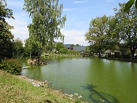
Village pond in Heidelheim
|
||
Heidelheim is a district of the city of Selb in the Wunsiedel district in the Fichtel Mountains (northeast Bavaria) in the Eger Valley .
location
Heidelheim is located about eight kilometers west of the center of the city of Selb and is connected to it via the St 2179. The A 93 runs east of Heidelheim . The German-Czech border runs approximately 15 kilometers to the east as the crow flies .
history
In the period between 1346 and 1378, during the time in office of Emperor Charles IV , Heidelheim was first mentioned in documents.
In 1818 the localities Steinselb and Buchbach were incorporated into Heidelheim by the royal district court in Selb . While the Buchbach district was reunified in 1953 and incorporated into Schönwald , Steinselb remained a district of the Heidelheim community.
The incorporation of Heidelheim with its district Steinselb to Selb took place on January 1, 1978.
Individual evidence
- ↑ Heidelheim. In: heidelheim.de. Retrieved April 16, 2015 .


