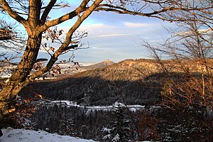
Heiligenkopf (Swabian Alb)
| Heiligenkopf | ||
|---|---|---|
|
|
||
| height | 893.1 m above sea level NHN | |
| location | Baden-Wuerttemberg , Germany | |
| Mountains | Swabian Alb | |
| Coordinates | 48 ° 17 ′ 39 " N , 8 ° 57 ′ 20" E | |
|
|
||
| rock | to the Impressamergel formation in the White Jura | |
The Heiligenkopf , also called Hailekopf , is 893.1 m above sea level. NHN high west spur of the eaves of the southwest Swabian Alb in the Zollernalb district between the Albstadt district of Onstmettingen on the Alb and the Bisingen village of Thanheim in the foreland.
Location and description

Half a kilometer east of the Spornspitze and only about 50 meters lower, the Schmiecha rises on the Alb plateau , which flows southeast to the Danube in the direction of the natural fall of the layers . In a 200-meter deep Kerbtal valley, less than a kilometer away on the southwest flank, the Klingenbach runs in the opposite direction to Eyach and Neckar in the foothills of the Alb, to which the short and close Auchterbach runs from the upper northwest slope. The main European watershed therefore runs along the edge of the slope of the spur .
The plateau lies in the Impressamergel formation , the lowest layer of the White Jura . Towards the Klingenbach a large mass has slipped on the southwest slope; apparently in association, since the slope profile here at about 820 m above sea level. NHN shows a clear gradation.
Hiking trails
The Main-Neckar-Rhein-Weg (main hiking trail 3) and the Schwäbische-Alb-Nordrand-Weg (main hiking trail 1) of the Swabian Alb Association lead from the Zollersteighof over the bladder mountain in the north along the slope edge over the Heiligenkopf. The Main-Neckar-Rhein-Weg leads around the valley of the Klingenbach in the south to the Irrenberg opposite. A local hiking trail marked with a blue triangle leads from here on the Heiligenkopf over the Spornkamm down to Thanheim .
The Albstädter premium hiking trail Traufgang 3 Zollernburg Panorama also leads over the Heiligenkopf.
Individual evidence
- ↑ Map services of the Federal Agency for Nature Conservation ( information )
- ↑ Geology according to the layers for Geological Map 1: 50,000 on: Map server of the State Office for Geology, Raw Materials and Mining (LGRB) ( notes )
- ↑ Hiking trails to Geoportal Baden-Württemberg ( information )
literature
- Topographic map 1: 25,000 Baden-Württemberg, as single sheet No. 7719 Balingen

