Hermannskoppe
| Hermannskoppe | ||
|---|---|---|
|
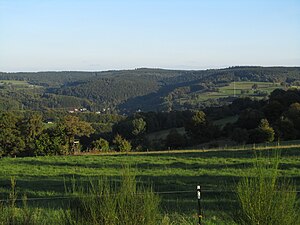
Hermannskoppe from the northwest |
||
| height | 567 m above sea level NHN | |
| location | Hessen , Germany | |
| Mountains | Spessart | |
| Dominance | 22.6 km → Geiersberg | |
| Notch height | 170 m ↓ Merneser Kreuz | |
| Coordinates | 50 ° 6 '26 " N , 9 ° 31' 0" E | |
|
|
||
The Hermannskoppe is 567 m above sea level. NHN the highest mountain in the Hessian part of the Spessart in the Main-Kinzig district .
geography
The Hermannskoppe is the fourth highest mountain in the Spessart. Its summit is located in the district of Lohrhaupten , a district of the municipality of Flörsbachtal , about 100 meters east of the border between Bavaria and Hesse . To the northwest of the summit, the road runs between Lohrhaupten (Hesse) and Ruppertshütten (Bavaria). The mountain was partially deforested in January 2007 by Hurricane Kyrill .
The Franconian Marienweg and the historic Birkenhainer Straße with the former customs house Bayerische Schanz run over the Hermannskoppe . The forest of silence is close by . The districts of Rengersbrunn , Ruppertshütten and the community-free area of Ruppertshüttener Forst extend on the eastern slopes of Bavaria . To the south of the Hermannskoppe lies the Eichenberg , in between the Lohrberg (537 m), to the east was the Einsiedel monastery . The Sperkelbach rises in a valley west of the Hermannskoppe .


