Hirtenbach (Ihme)
|
Hirtenbach Baeke |
||
|
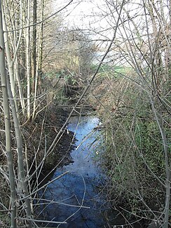
The Hirtenbach before crossing under the main road in Wettbergen |
||
| Data | ||
| Water code | DE : 488764 | |
| location | Germany , Lower Saxony , Region Hannover | |
| River system | Weser | |
| Drain over | Ihme → Leine → Aller → Weser → North Sea | |
| source | east of Gehrden 52 ° 18 ′ 36 ″ N , 9 ° 37 ′ 30 ″ E |
|
| Source height | approx. 65 m above sea level NN | |
| muzzle | near Hemmingen-Westerfeld in the Ihme coordinates: 52 ° 19 '26 " N , 9 ° 42' 52" E 52 ° 19 '26 " N , 9 ° 42' 52" E |
|
| Mouth height | 56 m above sea level NN | |
| Height difference | approx. 9 m | |
| Bottom slope | approx. 1.1 ‰ | |
| length | 8 kilometers | |
| Left tributaries | Wettberger Bach | |
| Big cities | Hanover | |
| Medium-sized cities | Ronnenberg | |
The Hirtenbach is an approximately eight kilometers long left tributary of the Ihme in the Hanover region in Lower Saxony.
geography
The Hirtenbach is created as a ditch on the northeast side of the district road 231n from Gehrden to Weetzen . The Haferriede runs along the southwest side of the street . The Hirtenbach flows straightened in north to east leading ditch sections, along the northern edge of Ronnenberg, whereby the railway line Hannover-Altenbeken is crossed. After a stretch through the Feldmark, it takes in the Wettberger Bach on the west of the Hanoverian district Wettbergen , crosses under the federal highway 217 and flows through Wettbergen. The stream runs from Wettbergen to the east, where the Hirtenbach flows into the Ihme at the northwest corner of the Westerfeld district of Hemmingen .
Sights and buildings
Before leaving Ronnenberg, the Hirtenbach flows along the listed old masonry. The buildings erected around 1900 are now used by the Ronnenberg road maintenance depot.
