Hirvensalmi
| coat of arms | map |
|---|---|

|

|
| Basic data | |
| State : |
|
| Landscape : | South Savo |
| Administrative community : | Mikkeli |
| Geographical location | 61 ° 39 ′ N , 26 ° 46 ′ E |
| Surface: | 746.59 km² |
| of which land area: | 465.39 km² |
| of which inland waterways: | 281.20 km² |
| Residents : | 2,152 (Dec. 31, 2018) |
| Population density : | 4.6 inhabitants / km² |
| Municipality number : | 097 |
| Language (s) : | Finnish |
| Website : | www.hirvensalmi.fi |
Hirvensalmi [ ˈhirʋenˌsɑlmi ] is a municipality in southeastern Finland. It is located west of the town of Mikkeli in the middle of the Finnish lake district south of Lake Puulavesi.
Hirvensami was as a parish independent in 1851, as a political community in 1868 by Mikkeli. In addition to the church village Hirvensallmi, it includes the towns of Hirvenlahti, Hurrila, Hämeenmäki, Kekkola, Kilkki, Kotkatvesi, Kuitula, Lahnaniemi, Lelkola, Malvaniemi, Merrasmäki, Monikkala, Parkkola, Puukonsayari, Pyöripäsilä, Syörniläynsa, Pämöyynsa, Pämöyynsa, Pämoki, Pämatti, Päatti, Pämi, Päatti , Vahvamäki, Vahvaselkä, Väisälä.
The parish church of Hirvensalmi is a granite building built in 1915 according to plans by Josef Stenbäck in the style of Finnish national romanticism.
In Pääskyniemi is the Futuro No. 001, apart from the prototype, the first Futuro to be built. It is a prefabricated plastic house from 1968, which was designed by the Finnish architect Matti Suuronen.
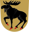
coat of arms
Description of the coat of arms : "In the golden shield a black elk with red hooves".
Web links
Individual evidence
- ↑ Maanmittauslaitos (Finnish land surveying office): Suomen pinta-alat kunnittain January 1, 2010 (PDF; 199 kB).
- ↑ Statistical Office Finland: Table 11ra - Key figures on population by region, 1990-2018
