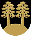
Mäntyharju
| coat of arms | map |
|---|---|

|

|
| Basic data | |
| State : |
|
| Landscape : | South Savo |
| Administrative community : | Mikkeli |
| Geographical location | 61 ° 25 ' N , 26 ° 53' E |
| Surface: | 1,210.81 km² |
| of which land area: | 981.77 km² |
| of which inland waterways: | 229.04 km² |
| Residents : | 5,924 (Dec. 31, 2018) |
| Population density : | 6 people / km² |
| Municipality number : | 507 |
| Language (s) : | Finnish |
| Website : | www.mantyharju.fi |
Mäntyharju [ ˈmæntyˌɦɑrju ] is a municipality in southeastern Finland . It is located 45 kilometers south of the town of Mikkeli on the western edge of the Finnish Lake District .
In addition to the parish village of Mäntyharju, it includes the towns of Ahvenisto, Anettu, Enolahti, Halmeniemi, Hietaniemi, Huopola, Hyyrylä, Hölttä, Jäniskylä, Karankamäki, Kinni, Koirakivi, Korpilahti, Kousaniemkeppä, Luhajärvi, Kousaniemkeppä, Lahnälihtanen, Kiemukorpi, Kuhajärvi. Mynttilä, Niinimäki, Nurmaa, Ollikkala, Outila, Paasola, Partsinmaa, Poitsiniemi, Pyhäkoski, Pärnämäki, Saviniemi, Särkemäki, Tiilikkala, Toivola, Valtola, Vanonen and Varpanen. Around 4,500 of the 5,924 residents live in the center around the train station and in the church village. In addition to the permanently inhabited places, there are around 4,400 holiday homes ( Mökkis ) in the municipality. The number of inhabitants increases considerably, especially during the summer holidays.
Mäntyharju was founded as a parish in 1595 by the chaplain Jaakko Pietarinpoika. The administrative and territorial history of the sock is extremely complicated, as Mäntyharju is on the border of three different landscapes , namely Savo , Häme and Karelia . After the Treaty of Åbo in 1743, the border between the Swedish and Russian empires also ran through the municipality. Only after all of Finland fell to Russia in 1809 was the divided Mäntyharju reunited in 1812. The municipality has existed within its current boundaries since 1929, when the village of Pertunmaa became independent and left the municipal association.
The parish church of Mäntyharju, consecrated in 1822, was built according to plans by Charles Bassi and is the second largest wooden church in Finland. It offers space for around 2000 believers. The neighboring parish was established as early as 1811-12.
Sons and daughters of the church
- Edward Vesala (* 1945; † 1999), jazz musician
- Antti Häkkänen (* 1985), politician
Web links
Individual evidence
- ↑ Maanmittauslaitos (Finnish land surveying office): Suomen pinta-alat kunnittain January 1, 2010 (PDF; 199 kB)
- ↑ Statistical Office Finland: Table 11ra - Key figures on population by region, 1990-2018