Holtebach
| Holtebach | ||
|
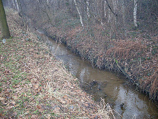
The Holtebach in Hövelhof |
||
| Data | ||
| Water code | DE : 311122 | |
| location | North Rhine-Westphalia , Germany | |
| River system | Ems | |
| Drain over | Schwarzwasserbach → Ems → North Sea | |
| source | In the Senne within the NSG Moosheide 51 ° 50 ′ 36 ″ N , 8 ° 41 ′ 33 ″ E |
|
| Source height | approx. 123 m above sea level NN | |
| muzzle | Northeast of Espeln in the Schwarzwasserbach Coordinates: 51 ° 49 ′ 32 " N , 8 ° 37 ′ 2" E 51 ° 49 ′ 32 " N , 8 ° 37 ′ 2" E |
|
| Mouth height | approx. 97 m above sea level NN | |
| Height difference | approx. 26 m | |
| Bottom slope | approx. 4.1 ‰ | |
| length | 6.4 km | |
| Catchment area | 9.384 km² | |
| Right tributaries | Hallerbach | |
| Communities | Hövelhof | |
The Holtebach is an orographically right tributary of the Schwarzwasserbach in North Rhine-Westphalia , Germany . It has a length of 6.4 km.
River course
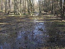
The Holtebach rises in the Senne within the Moosheide nature reserve , not far from the "Hövelsenne" service area on the federal highway 33 . The sources of the Ems are also in this area. Like most of the brooks in this region, the water flows away in a south-westerly direction and initially crosses the Hövelhofer forest that adjoins the Moosheide in a natural and meandering floodplain . The Holtebach then crosses the Hövelhofer industrial area and is dammed there in several places for the purpose of storing extinguishing water .
Thereupon the right-hand image of the Hallerbach , which runs almost parallel to the Holtebach and to which there is already a connection via the trench system in the Hövelhofer forest, takes place in the re-wooded terrain . To the northeast of Espeln , the Holtebach flows into the Schwarzwasserbach on the right-hand side within a complex of meadows and grassland known as "Haller", which flows into the Ems shortly afterwards .
Characteristic
Characteristic for the source area of the Holtebach is the rust-red color of its water, which is caused by iron hydroxide condensed in places underground to form lawn iron ore deposits . For this reason, the area is also known as "Rosenlake", which can be interpreted as "red lake ". In contrast to the neighboring rivers, which have partly formed deep trough valleys, the Holtebach has only slightly cut into its surroundings in its source area. The water has largely a very near-natural, meandering brook meadow accompanied by alder breaks. Above the source area, in which there are also inland dunes and drifting sand formations, the stream continues as a forking dry valley .
Differences in classification
Contrary to the official name, as evidenced by geodata material , the Holtebach is also referred to as the "Lower Hallerbach", and in some cases the entire lower reaches as the "Hallerbach". Some sources even see the Hallerbach as the mouth of the Schwarzwasserbach. In fact, the length of the Holtebach watercourse is also slightly higher than that of the Schwarzwasserbach, but the latter has a larger discharge.
Flora and fauna
On the numerous turns of the Holtebachaue there are extensive stocks of holly . The Uferbehölzung in the meadow areas in the lower reaches forms with their stocks of field trees, oak groves and Kopfweiden an important habitat of numerous bird species.
etymology
The term "Holte" is a Low German name for a forest area. This part of the name is to be found more frequently in the area of the Ems sand plain , for example in the name of the neighboring town of Schloss Holte-Stukenbrock .
Individual evidence
- ↑ Topographic map 1: 25,000
- ^ German basic map 1: 5000
- ↑ a b Topographical Information Management, Cologne District Government, Department GEObasis NRW ( Notes )


