Huben (municipality of Längenfeld)
| Huben ( village ) | ||
|---|---|---|
|
|
||
| Basic data | ||
| Pole. District , state | Imst (IM), Tyrol | |
| Pole. local community | Längenfeld | |
| Locality | Huben | |
| Coordinates | 47 ° 2 '36 " N , 10 ° 58' 11" E | |
| height | 1189 m above sea level A. | |
| Residents of the stat. An H. | 1235 (October 31, 2011) | |
| Post Code | 6444 | |
| Statistical identification | ||
| Counting district / district | Huben-Gries (70208 001) | |
 Church and cemetery in Huben |
||
| Source: STAT : index of places ; BEV : GEONAM ; TIRIS | ||
Huben is a village and a former fraction of the municipality Längenfeld in the Imst district in Tyrol with 1235 inhabitants (as of 2011).
geography
The village of Huben is 1189 m above sea level. A. in the Ötztal above Längenfeld, at the southern end of the Längenfeld basin, a widening of the valley, on the left bank of the Ötztaler Ache .
The Huben fraction also included the villages of Astlehn and Runhof, the hamlets of Aschbach, Gottsgut, Mühl and Winkle, the Rotten Bruggen, Burgstein and Brand, the Armelen farm as well as two alpine inns, a refuge and several alpine pastures.
history

The name Huben is probably derived from Hube , a farm that provides for a family. In 1317, Schwaighöfe were mentioned in Huben .
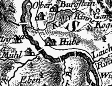
Due to its location on the valley floor, Huben was often affected by natural disasters, especially floods from the Ötztaler Ache. The Ache kept digging a new bed. It used to run on the western edge of the valley and Huben was, unlike today, on the right bank. When the Rofener Eisseee erupted on July 16, 1678, almost all the houses and the church in Huben were destroyed. Two houses, a chapel and the church tower were destroyed in a flood in 1868. In 1877, Huben was buried again and again in a rock fall , whereupon the government in Vienna considered moving the residents to Hungary, which was not realized due to their resistance.
The Church of St. Martin was rebuilt after the destruction in 1679 and enlarged due to the increased population in 1805/06. In 1891 Huben was raised to an independent parish.
Individual evidence
- ↑ Statistics Austria: Register census from October 31, 2011 - population by location (PDF; 6 kB)
- ↑ a b c Längenfeld , in the history database of the association "fontes historiae - sources of history"
- ↑ Tirol Atlas: Natural History Tyrol
- ^ Franckenstein, Wiesauer: Parish Church of St. Martin. In: Tyrolean art register . Retrieved August 16, 2014 .
