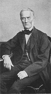
Joseph Gauss
Joseph Gauss (actually Carl Joseph Gauss * 21st August 1806 in Braunschweig ; † 4. July 1873 in Hannover ) was a German artillery officer , surveyor , railroad - Civil and construction officer, Mr .
Life
Joseph Gauß was born in 1806 as the first child of mathematician , astronomer and geodesist Carl Friedrich Gauß (1777–1855) and his wife Johanna Elisabeth Rosina, née Osthoff (1780–1809), in Braunschweig. He got his first name Joseph after the astronomer Giuseppe Piazzi (1746-1826), the discoverer of the dwarf planet Ceres .
Even as a teenager, Gauß supported his father with the work on the land surveying of the Kingdom of Hanover ( Gaußsche Landaufnahme ), which he carried out between 1818 and 1826. After a short period of study at the University of Göttingen , he joined the artillery corps of the army of the Kingdom of Hanover as a cadet in 1824 and was promoted to Premier-Lieutenant in 1834 .
During his military service he continued with triangulation measurements of Hanover and from 1832 worked together with the cartographer August Wilhelm Papen (1799-1858) on the creation of the map series Topographischer Atlas of the Kingdom of Hanover and Duchy of Braunschweig . The work with 66 map sheets on a scale of 1: 100,000 was published in 1847.
From April to November 1836 Gauss traveled to the United States to study the railroad there. On March 18, 1840, he married Sophie Friederike Erythropel (1818–1883) in Stade .
After 22 years of service, he retired from military service and in October 1846 joined the management of the Royal Hanoverian Railway , founded in 1843, as head of technical work. In this office, Gauss significantly influenced the expansion of the Hanoverian rail network. Around 1856 he received the title of senior building officer.
Joseph Gauß died in Hanover in 1873. His grave is in the Engesohde city cemetery in what is now the Südstadt district .
literature
- Joseph W. Dauben (Ed.): Mathematics celestial and terrestrial: Festschrift for Menso Folkerts on his 65th birthday. Wissenschaftliche Verlagsgesellschaft, Stuttgart 2008, ISBN 978-3-8047-2482-2 .
- Hans Wussing : Carl Friedrich Gauss. Teubner, Leipzig 1989, ISBN 978-3-322-00682-0 .
Web links
Individual evidence
- ↑ a b Wussing: Carl Friedrich Gauß. P. 44.
- ↑ Dieter Grothenn: August Papen and his "Topographical Atlas of the Kingdom of Hanover and Duchy of Braunschweig". In: News of the Lower Saxony Surveying and Cadastre Administration. Volume 46, No. 4, Hannover 1996, p. 152.
- ↑ a b Dauben: Mathematics celestial and terrestrial: Festschrift for Menso Folkerts on his 65th birthday. P. 597.
- ↑ Wolfgang Torge : History of geodesy in Germany. Walter de Gruyter, Berlin 2007, ISBN 978-3-11-019056-4 , p. 140.
| personal data | |
|---|---|
| SURNAME | Gauss, Joseph |
| ALTERNATIVE NAMES | Gauß, Carl Joseph (full name); Gauss, Josef |
| BRIEF DESCRIPTION | German artillery officer, geodesist and construction officer |
| DATE OF BIRTH | August 21, 1806 |
| PLACE OF BIRTH | Braunschweig |
| DATE OF DEATH | 4th July 1873 |
| Place of death | Hanover |


