
Köttlitz (Trausnitz)
|
Köttlitz
municipality Trausnitz
Coordinates: 49 ° 31 ′ 31 ″ N , 12 ° 14 ′ 53 ″ E
|
||
|---|---|---|
| Height : | 550 m | |
| Postal code : | 92555 | |
| Area code : | 09655 | |
Location of Köttlitz in Bavaria |
||
 Köttlitz (2016)
|
||

Köttlitz is a district in the Trausnitz municipality in the Schwandorf district .
geography
The village of Köttlitz is located about 25 km west of the border with the Czech Republic in the middle Upper Palatinate Forest , about 1 km west of the village of Trausnitz at an altitude of 540 meters. The place can be reached via the SAD 30 district road.
history
Slavic settlement
Slavic place names such as Gleiritsch , Hohentreswitz , Söllitz , Köttlitz or Trefnitz document an early settlement of the area around the Pfreimd . Slavic settlers infiltrating from the east met Bavarians advancing northwards from the south . In a further settlement phase, the focus of which was in the 10th and 11th centuries, a number of "dorf" places such as Pamsendorf , Fuchsendorf, Pischdorf or Altendorf emerged , to which "richt" places and "ried" places such as Trichenricht , Lampenricht or Zeinried followed. The Slavic-sounding place name Trausnitz is not one of these early settlement names. Initially it only referred to the Trausnitz and can be found in the files as "Traußnit, Trausniht, Trausnicht or Truwesnicht". The village was called Sächsenkirchen or Sessenkirchen until the end of the 14th century , the name of the castle was transferred to the village and the name Trausnitz was created.
Village of Köttlitz
In 1326 a record mentions the name "Choeteltz" (= Köttlitz) in connection with Trausnitz im Thal. The tax description of the Nabburg Nursing Office from 1630 reports in "Khöttlitz" of 1 farm and 2 goods. In 1714 Thomas Freiherr von Quentel bought the Trausnitz estate. A list from this time reports from 2 families in Köttlitz. In the hearth description of the Nabburg nursing office from 1721, it emerges that "Köttliz" had 3 properties, 3 houses and 3 fireplaces.
Tax District and Parish Education
The Kingdom of Bavaria was divided into 15 districts in 1808. These districts were named after rivers based on the French model ( Naabkreis , Regenkreis , Unterdonaukreis , etc.). The districts were divided into district courts. The districts in turn should be divided into individual municipality areas. In 1811 the district court of Nabburg was divided into 58 tax districts. One of them was Trausnitz, “consisting of the villages of Trausnitz with that of Kargschen Castle and Köttlitz, the deserted areas of Kaltenthal and Ödmühl, the manorial forest of Stein, called the Sölzer and Kotlitzer Dikigt, the manorial forest of Hohentreswitz, called the water wood, as well as the Anzerholz ”. The district had a total of 94 houses with 629 inhabitants. In the same year there were 22 chairmen in the district court of Nabburg, which corresponds to a municipality in today's sense. The chairmanship of Trausnitz included Trausnitz, Kaltenthal, Fuchsendorf, Köttlitz, Atzenhof, Schweizerbach, Bornmühle and Ödmühle. In 1828 there were 12 residential buildings with 12 families and 87 residents in Köttlitz, which belonged to the municipality of Söllitz.
Incorporation into the Trausnitz community
On 1 May 1978 the municipality Söllitz, belonged to the Koettlitz dissolved and the church Trausnitz incorporated .
photos

Köttlitz (2016)

Bell Tower (2016)
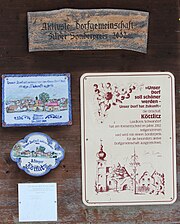
Active village community


literature
- Alois Köppl: From the history of the community Gleiritsch . 2nd edition, Gleiritsch 1988
- Alois Köppl: Gleiritsch - an old place name in the Upper Palatinate. in: Die Oberpfalz, 71st year, pp. 108-109.
- Ernst Schwarz: Language and Settlement in Northeast Bavaria . Nuremberg 1960
- Elisabeth Müller-Luckner: Historical Atlas of Bavaria . Part Altbayern, Heft 50, Nabburg, Munich 1981, ISBN 3-7696-9915-7
- Monumenta Boica, 36 / I, p. 617
- State Archives Amberg, Stand Book No. 360
Web links
Individual evidence
- ↑ Alois Köppl, From the history of the community of Gleiritsch, p. 33
- ↑ Elisabeth Müller-Luckner, Historical Atlas of Bavaria, part of Old Bavaria, issue 50, Nabburg, p. 246
- ↑ Monumenta Boica, 36 / I, p. 617
- ↑ Amberg State Archives, Rent Office No. 834
- ↑ State Archives Amberg, Stand Book No. 360
- ↑ Description of the herd place of the Nabburg Nursing Office 1721, Amberg State Archives, No. 1316
- ^ Emmering, Ernst, The Government of the Upper Palatinate, History of a Bavarian Central Authority, Contributions to the History and Regional Studies of the Upper Palatinate, Issue 20, Regensburg 1981, p. 12 ff.
- ^ Elisabeth Müller-Luckner, Historical Atlas of Bavaria, part of Altbayern, issue 50, Nabburg, p. 402
- ^ Elisabeth Müller-Luckner, Historical Atlas of Bavaria, part of Altbayern, issue 50, Nabburg, p. 409
- ↑ Elisabeth Müller-Luckner: Historical Atlas of Bavaria, part of Old Bavaria, issue 50, Nabburg, p. 429
- ^ Federal Statistical Office (ed.): Historical municipality directory for the Federal Republic of Germany. Name, border and key number changes in municipalities, counties and administrative districts from May 27, 1970 to December 31, 1982 . W. Kohlhammer GmbH, Stuttgart / Mainz 1983, ISBN 3-17-003263-1 , p. 668 .

Atzenhof | Bierlhof | Kaltenthal | Köttlitz | Oberpierlhof | Ödmühl | Reisach | Schweizerbach | Söllitz | Trausnitz