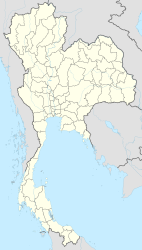
Kanchanaburi
|
กาญจนบุรี Kanchanaburi |
||
|---|---|---|
|
|
||
| Coordinates | 14 ° 1 ' N , 99 ° 32' E | |
| Basic data | ||
| Country | Thailand | |
| Kanchanaburi | ||
| ISO 3166-2 | TH-71 | |
| Residents | 29,584 (2013) | |
|
Lak Mueang (center of town) from Kanchanaburi
|
||
Kanchanaburi ( Thai : กาญจนบุรี , [ kaːntɕànábùriː ]; colloquially often just called Kan or Kan Buri ) is the capital of the Kanchanaburi province in the west of the central region of Thailand .
Kanchanaburi is partly in the district ( Amphoe ) Mueang Kanchanaburi and partly in Amphoe Tha Muang . It has had the administrative status of a "city municipality" ( Thesaban Mueang ) since 1935 and in 2013 had 29,584 inhabitants.
geography
Kanchanaburi is located at the confluence of the Mae Nam Khwae Noi with the Mae Nam Khwae Yai , which is called Mae Nam Mae Klong from then on . The city is about 130 km from the capital Bangkok .
climate
|
Monthly average temperatures and rainfall for Kanchanaburi
|
Economy and Importance
The fertile soil in the area is used intensively: the main products, besides the obligatory rice, are sugar cane, cassava, corn, tobacco and cotton.
The city and the surrounding area also live well from the tourist offer. On the one hand the wonderful landscape, on the other hand the world-famous novel or the film " The Bridge on the Kwai " contributes to this. In addition, many capital city dwellers come here for short breaks to relax or have fun on the Maenam Kwai's disco boats.
In the mountainous landscape to the west and north of Kanchanaburi there are numerous high-yield gem mines . Here you can find sapphires and spinel .
history
The area around Kanchanaburi has been inhabited since the Stone Age, as finds from burial sites show.
The city ( Mueang ) is also an early establishment, but was only moved to its current location in 1833 under King Nang Klao ( Rama III ) .
Attractions
- River Kwai Bridge - During the Second World War , the Japanese occupying forces used Asian slave labor and Western prisoners of war to build an important railway bridge over the Khwae Yai to provide logistical support for the Japanese occupation of Burma: the bridge on the Kwai, known from literature and film . Since about 100,000 Asian and Western 16,000 workers died, the rail link to Burma "was Death Railway " (Death Railway) called.
- Wat Pa Luangta Bua Monastery - the monastery built in 1994 is a very popular destination for tourists and is mainly known for being able to see and stroke the (allegedly orphaned) tigers that live there.
- Wat Tham Khao Pun Monastery - a cave temple on a hill near Kanchanaburi with a beautiful view of the Khwae Noi
sons and daughters of the town
- Pramote Teerawiwatana (1967-2012), badminton player
- Wiradech Kothny (* 1979), fencer
- Patiparn Phetphun (* 1980), football player
- Kosin Hembut (* 1982), football player
- Duangta Kongthong (* 1982), singer
- Sompob Nilwong (born 1983), football player
- Suchao Nuchnum (* 1983), soccer player
- Jakkrit Khemnak (* 1987), football player
- Praweenwat Boonyong (* 1990), football player
- Supot Jodjam (* 1990), football player
- Kritsana Kasemkulvilai (* 1990), football player
- Sakda Kumkun (* 1990), soccer player
- Panwat Gimsrang (* 1995), hammer thrower
literature
Books
- Stuart Young: Life on the Death Railway , Pen & Sword Books, Barnsley, 2013
E-books
- Axel Ertelt : Kanchanaburi and the Bridge on the Kwai , E-Book, Ancient Mail Verlag, Groß-Gerau, 2013
Web links
- Kanchanaburi City Map (names in English and Thai) [accessed November 29, 2015]
Individual evidence
- ↑ รายงาน สถิติ จำนวน ประชากร และ บ้าน ประจำ ปี พ.ศ. 2556 , Department of Provincial Administration Population Statistics , 2013.

