Karl-Marx-Graben
| Karl-Marx-Graben | ||
|
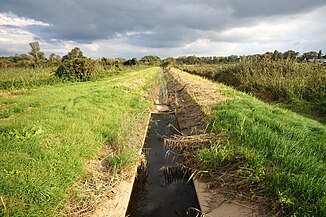
The Karl-Marx-Graben near the Worms airfield |
||
| Data | ||
| location | Germany | |
| River system | Rhine | |
| Drain over | Eckbach → Rhine → North Sea | |
| source | in Worms at Klosterstrasse 49 ° 37 ′ 2 ″ N , 8 ° 21 ′ 27 ″ E |
|
| Source height | approx. 95 m above sea level NHN | |
| muzzle | in the Wormser Ried from the left into the Eckbach Coordinates: 49 ° 36 '16 " N , 8 ° 23' 28" E 49 ° 36 '16 " N , 8 ° 23' 28" E |
|
| Mouth height | approx. 91 m above sea level NHN | |
| Height difference | approx. 4 m | |
| Bottom slope | approx. 1.1 ‰ | |
| length | approx. 3.5 km | |
| Catchment area | 15.35 km² | |
| Medium-sized cities | Worms | |
The Karl-Marx-Graben is an approximately 3.52 km long stream and an orographically left tributary of the Eckbach . It runs along its entire length within the Rhine-Hessian city of Worms ( Rhineland-Palatinate ).
course
The origin of the Karl-Marx-Graben lies at about 95 m above sea level. NHN southwest of the Worms town center on the edge of the Klosterstrasse, along which it initially flows about 800 m to the south and drains the Worms southwest.
At the end of Klosterstrasse, it meets the more water-rich Eisbach , coming from the south-west on the right , into which it used to flow. This estuary was closed in the 20th century to make the south-east of Worms less prone to flooding in the Eisbach. Since then, the Karl-Marx-Graben has been canalized from this point and turns left in front of the Eisbach to the northeast, in order to cross under the Landesstraße 523 (Worms- Bobenheim-Roxheim ) together with it and flow parallel next to the Eisbach. After about 800 m, the Karl-Marx-Graben - now in the embankment - is diverted to the right over the Eisbach and directed to the southeast. In doing so, he passes the northeast edge of the Worms airfield and crosses under the district road 7, the connection between the federal road 9 ( Mainz - Ludwigshafen ) and the state road 523.
After 1.9 km it flows in the Wormser Ried in an easterly direction under the B 9 and immediately afterwards flows into the Eckbach from the left at a height of about 91 m .
Individual evidence
- ↑ a b c d e GeoExplorer of the Rhineland-Palatinate Water Management Authority ( information )
