
Karpfenschänke
|
Karpfenschänke
Diera-Zehren municipality
Coordinates: 51 ° 11 ′ 15 " N , 13 ° 26 ′ 39" E
|
||
|---|---|---|
| Residents : | 62 (May 9, 2011) | |
| Postal code : | 01665 | |
Location of Karpfenschänke in Saxony |
||


Karpfenschänke is a district of the Saxon community Diera-Zehren in the district of Meißen .
geography
Karpfenschänke is located directly on the right bank of the Elbe on the road from the district town of Meißen to Zadel . Another road branches off in town to Diera . On the other side of the Elbe, federal road 6 runs from Meißen towards Riesa . Neighboring towns are Diera in the north, Naundörfel in the northeast , Winkwitz in the east and southeast , Keilbusch in the south, Jesseritz in the southwest and Mischwitz in the west . Zadel joins in the northwest. Diera, Naundörfel, Keilbusch and Mischwitz are districts of the municipality of Diera-Zehren, Winkwitz belongs to the district town of Meißen and Jesseritz to Käbschützal .
history

In 1537, a ferry from Holzung Keilbusch to the other bank of the Elbe (today Karpfenschänke) in the village of Diera was mentioned at kilometer 86 of the Elbe river. Three farmers in the village had to "each hold a bridge, the community benefited if they were badarfed". Presumably, a well-developed field path developed from the Dieraer Gasthof Zur Post over the Kellerstraße to the Elbe, so that the Dierau farmers could use the then uninhabited Elbe meadows for cattle farming. Another dirt road to the ferry ran through the Elbe to Zadel. There has always been a towpath along the Elbe . A higher natural widening was used to store goods such as wood, coal and grain. The Karpfenschänke restaurant was also built on this plateau in the 18th century, giving the later district its name. In 1791 the road on the right bank of the Elbe was moved into the Elbe Valley, so that a row of houses developed in Keilbusch . Gradually now Dieraer and Zadeler built winery and in the carp tavern with the local granite other economies and building for cottagers which the ship puller , Steinbrecher and sailors were involved and by the way operated some agriculture and livestock. Excursion traffic developed through the restaurants "Nicolsmühle" (1840) and "Güldene Aue" (1841). As a result, the ferry was licensed in 1885. The place has always been part of the then independent municipality of Diera. With the merger of the independent towns of Diera and Zehren on January 1, 1999, Karpfenschänke became part of the new municipality.
Nothing is known about the origin of the name. However, there are two possible explanations for the origin of the name:

- In the first, the place name comes from a large stone on the banks of the Elbe that is said to have looked like the head of a carp . In the Elbe Shipping Act of 1821, the riverside states committed themselves to freedom of shipping and to regulating the river for shipping by means of electricity construction measures, from 1866 in what is now the German area under the direction of the Elbe river administration established in Magdeburg. In 1870, in distant Magdeburg, the fate of the Uferstein was sealed and its removal decided.
- In the second variant, the name comes from the catch of a large carp under this stone.
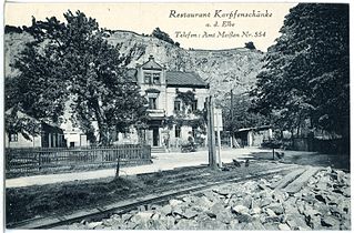
- Historical views of Karpfenschänke

Karpfenschänke 1908

View over the Elbe to Karpfenschänke 1908
Karpfenschänke 1928


Web links
Individual evidence
- ^ Population, households, families as well as buildings and apartments on May 9, 2011 according to parts of the municipality. (PDF; 690 KB) In: Kleinräumiges Gemeindeblatt Census 2011. Statistisches Landesamt Sachsen , p. 5 , accessed on October 4, 2016 .
- ↑ Ferry Keilbusch - Diera / Karpfenschänke KF Km