
Kinzigtäler Jakobusweg
| Kinzigtäler Jakobusweg | |
|---|---|
| Data | |
| length | 130 km |
| location | Baden-Württemberg |
| Starting point |
Loßburg , Hauptstrasse 48 ° 24 ′ 41.7 ″ N , 8 ° 27 ′ 10.7 ″ E |
| Target point |
Throat 48 ° 34 '21.1 " N , 7 ° 48' 14.9" E |
| Type | Long-distance hiking trail |
| The highest point | 808 m above sea level |
| Lowest point | 136 m above sea level |
| season | Spring to autumn |
The Kinzigtäler Jakobusweg is a section in the network of the Jakobsweg in Germany . It leads from the former Jakobus Church (today a community center) in Lossburg through the Kinzig valley to Kehl . From there it goes on a feeder road to Strasbourg , where you can continue your pilgrimage on the Alsatian Way of St. James.
history
In the Kinzig valley there are numerous examples of the cult of St. James, which are visible to everyone in the form of sacred buildings under the patronage of the apostle St. Ä. In 1409 a little church called St. Jakob in Lossburg was mentioned for the first time in a document. In addition, evidence of pilgrimages has been preserved in old documents, for example an entry in the Haslach church book from 1610 or a Latin translation of a pilgrimage letter from 1656, which is in the Zell city archive. The idea for the Kinzig Valley Way of St. James came up in 1992 during a pilgrimage to Santiago de Compostela . The main initiator and motor for setting up and signposting the pilgrimage route was local researcher Kurt Klein from Hausach . Just one year later, on St. James Day 1993 (July 25), the path was inaugurated with a festive service in the St. James Chapel in Wolfach .
course
The Kinzigtäler Jakobusweg is integrated into the extensive network of Jakobsweges in Europe and leads from Loßburg through the Kinzig valley to Schutterwald and then to Kehl am Rhein. From the east, the gap from Horb - Ihlingen to Lossburg was closed in 1994 , so that one can now make a pilgrimage from Rottenburg am Neckar to France on marked paths.
| Suggested stage | Stage length | Places in order of reaching |
| Stage 1 | approx. 16 km | Loßburg - Alpirsbach - Rötenbach - Schenkenzell |
| Stage 2 | approx. 23 km | Schenkenzell - Wittichen Monastery - St. Roman - Wolfach |
| Stage 3 | approx. 20 km | Wolfach - Hausach - Mühlenbach - Haslach im Kinzigtal |
| Stage 4 | approx. 16 km | Haslach - Steinach - Zell am Harmersbach |
| Stage 5 | approx. 15 km | Zell am Harmersbach - Nordrach - Gengenbach |
| Stage 6 | approx. 16 km | Gengenbach - Offenburg - Schutterwald |
| Stage 7 | approx. 22 km | Schutterwald - Kehl |
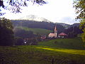
Power on

St. Laurentius, Wolfach

St. Mauritius, Hausach


.JPG)
James traces
In the course of the Kinzigtäler Jakobusweg you can find some Jakobus traces and representations.
| place | description |
| Lossburg | Pilgrim stone (1993) at the former Jakobuskirche (1833) |
| Thigh cell | Pilgrim Stone (1994) |
| Salt lick | Pilgrim Cross (1993) |
| Power on | Pilgrim Stone (1997) |
| Kreuzacker | Pilgrim Cross (1993) |
| Wolfach |
Jakobuskapelle (1660) Pilgerstein (1993) Representation of Jakobus in the parish church |
| Käppelehof, Wendelinus Chapel | James statue |
| Hausach | James Fountain (2001) |
| Mühlenbach, St. Afra Church | James statue on the right side altar |
| Gengenbach | Jakobuskapelle (1682) Pilgrim stone (2004) |
| Ortenberg, Bühlweg-Kirchlein | James statue |
| Schutterwald | St. Jakobus Church (1787) Pilgrim stone (1993) Jakobus statue at the parish hall of St. Jakob |
| Kehl, Rhine promenade | Pilgrim Stone (2008) |

Pilgrim stone, Schenkenzell

Pilgrim stamp
In almost every stage there is the possibility to have a pilgrim stamp for your pilgrim ID ( Spanish credencial ).
literature
- Kurt Klein: The Kinzigtäler Jakobusweg . 3. Edition. TBB-Medien, Baden-Baden 2013, ISBN 978-3-941615-02-1 .
Web links
- Website of the Kinzigtäler Jakobusfreunde
- GPS data on Wanderkompass.de
- Directions and GPS tracks at Schwarzwald-Tourismus.info
Individual evidence
- ↑ Hans Saile: Historical lecture 600 years Jakobuskirche in Loßburg. (PDF) December 23, 2009, accessed January 3, 2014 .
- ↑ saint-jacques-alsace.org
- ↑ Pilgrim's stamp Kinzigtäler Jakobusweg. Retrieved January 3, 2014 .