Kirnberg (Bebenhausen)
| Kirnberg | ||
|---|---|---|
|
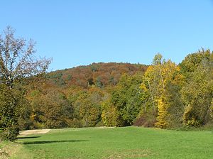
Kirnberg from the south |
||
| height | 466.2 m above sea level NHN | |
| location | near Bebenhausen ; District of Tübingen , Baden-Württemberg ( Germany ) | |
| Coordinates | 48 ° 33 '27 " N , 9 ° 4' 29" E | |
|
|
||
The Kirnberg near Bebenhausen is 466.2 m above sea level. NHN high mountain of the Schönbuch in the Baden-Württemberg district of Tübingen .
geography
location
The Kirnberg rises in the Schönbuch Nature Park . Its summit is 4.4 km north-north-east of downtown Tübingen and 1 km south-east of Bebenhausen , 3.3 km north-north-west of Lustnau and 3 km north-west of Pfrondorf ; which all belong to Tübingen. The Goldersbach flows southwest past the mountain and its tributary Kirnbach to the southeast .
Natural allocation
The Kirnberg belongs to the natural spatial main unit group Swabian Keuper-Lias-Land (No. 10), in the main unit Schönbuch and Glemswald (104) and in the subunit Schönbuch (104.1) to the natural area Südlicher Schönbuch (104.12). Neighboring natural spaces close to the mountains are: Northern Schönbuch (104.15) in the northeast and Walddorfer Platten (104.13) in the south to southeast.
Protected areas
Parts of the landscape protection area Schönbuch ( CDDA -Nr. 324242; designated 1967; 67.1643 km² ), the Fauna-Flora-Habitat- Area Schönbuch (FFH-Nr. 7420-341; 112.4713 km²) and the Bird sanctuary Schönbuch (VSG No. 7420-441; 153.6203 km²).
Geological nature trail Kirnberg and Olgahain

The Kirnberg Geological Trail is around 3 km long and was laid out in 1977 for the 500th anniversary of the University of Tübingen . The deposits of the south-west German Keuper bergland ( claystone , marl and sandstone ) are explained on 13 panels and the geology of the Tübingen area is described. The path extends from the Keuper sediments of the lower colored marl to the area of younger Keuper deposits ( silica sandstone , upper colored marl , Stubensandstein , tuber marl and Rhätsandstein ).
On the southern flank of the Kirnberg, surrounded by the nature trail, lies the Olgahain above the confluence of the Kirnbach and the Goldersbach . This mixture of forest landscape and park was created at the instigation of Karl Friedrich Alexander von Württemberg and named after his wife Olga Nikolajewna Romanowa (1822-1892) .
See also
List of mountains and elevations in the Schönbuch
literature
- Johannes Baier: The geological nature trail on the Kirnberg (Schönbuch) - The Keuper's past . Fossils 31 (5), 36–40, 2014.
- Johannes Baier: The new geological nature trail in Kirnbachtal (Keuper, Schönbuch). Exposure 71 (2), 81–89, 2020.
Individual evidence
- ↑ a b c Map services of the Federal Agency for Nature Conservation ( information )
- ^ Friedrich Huttenlocher , Hansjörg Dongus : Geographical land survey: The natural spatial units on sheet 170 Stuttgart. Federal Institute for Regional Studies, Bad Godesberg 1949, revised 1967. → Online map (PDF; 4.0 MB)
- ↑ The geological nature trail on Kirnberg , on naturpark-schoenbuch.de
- ↑ Johannes Baier: The geological educational trail on the Kirnberg (Keuper; SW Germany) ; Annual reports and communications from the Upper Rhine Geological Association, Vol. 93, 2011, pp. 9–26
- ↑ Olgahain , on naturpark-schoenbuch.de
- ↑ Olgahain , on tuepedia.de


