List of mountains and elevations in the Schönbuch
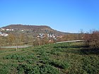
The list of mountains and elevations of the Schönbuch contains a nearly complete selection of mountains and elevations as well as their foothills of the Schönbuch , a forest area of the southern German Keuper Hills , and the nature park Schönbuch in the German state of Baden-Württemberg .
The columns of the table sorted by height in meters (m) above sea level in the initial view can be sorted by clicking on the symbols next to their headings.
The abbreviations used in the table below illustrates.
| Mountain elevation foothills |
Height (m) |
image | location | Agricultural circle / e * |
Place of (possibly note) * |
|---|---|---|---|---|---|
| Bromberg | 582.6 |  |
in the Schönbuch center between Entringen and Altdorf | BB | Hermitage Former chapel Schonwald Diebsteig , |
| Stellberg | 580.3 |  |
on the western edge of the Schönbuch 3.5 km northeast of Herrenberg | BB | Recultivated garbage and earth dump, former quarry |
| Rock garden | 566.1 | in the Schönbuch center between Entringen and Weil | TÜ | ||
| Kapf | 566.0 |  |
north-northwest of Mönchberg | BB | |
| Grafenberg | 560.9 |  |
north of Kayh | BB |
NSG Grafenberg (23.9 ha; 480-560 m; August 19, 1969) |
| Kirnberg | 558.9 | Bromberg north-west foothills | BB | ||
| Rötelberg | 555.5 | Part of the Rohrau Heads southeast of Rohrau | BB | ||
| Schönbuchspitz | 546.1 |  |
north-northeast of Entringen | TÜ |
NSG Schönbuch-Westhang / Ammerbuch (459.0 ha; 360-540 m; November 15, 2000) (with Pfaffenkopf in front of the south ) |
| Breitenholz Castle Hill | 543.1 | east-northeast of Breitenholz | TÜ |
Müneck Castle , NSG Schönbuch-Westhang / Ammerbuch (459.0 ha; 360-540 m; November 15, 2000) |
|
| Falcon head | 532.2 | Bromberg southwest foothills | BB | ||
|
Herrenberg Castle Hill |
522.8 |  |
in Herrenberg | BB |
Herrenberg Castle Ruins (with AT ), Herrenberg Collegiate Church (southwest slope) |
|
Rohrau Castle Hill |
520 | Part of the Rohrauer Köpf , Rötelberg western foothills, south of Rohrau |
BB | lost Rohrau Castle | |
| Horn head | 515.2 | north hail hole | TÜ | ||
| Schlossberg wrestling | 509.9 |  |
east of Entringen | TÜ | Hohenentringen Castle , NSG Schönbuch-Westhang / Ammerbuch (459.0 ha; 360-540 m; November 15, 2000) |
| Oak ridge | 502.0 | in the Schönbuch center between Dettenhausen and Pfrondorf |
RT , TÜ |
NSG Schaichtal (205.9 ha; 320–360 m; February 23, 1995) , NSG Eisenbachhain (8.3 ha; 470–490 m; 23 August 1937) |
|
| Betzenberg | 499.5 |  |
south-southwest of Glashütte |
BB , IT |
Telecommunications tower Waldenbuch , Celtic Viereckschanze, NSG Schaichtal (205.9 ha; 320–360 m; February 23, 1995) , Betzenberg educational forest trail |
|
Steinenberg (Tübingen) |
492.0 |  |
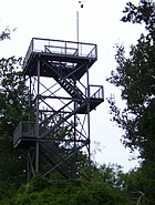
on the northwestern edge of Tübingen | TÜ | Steinenberg Tower ( AT ) |
| Gunzberg | 490.5 | west-southwest of Dettenhausen | BB | ||
|
Kapellenberg (Wurmlinger Berg) |
475 |  |
southwest of Tübingen , east of Hirschau |
TÜ |
Sankt-Remigius-Kapelle (Wurmlinger Chapel) |
| Spitzberg | 474.4 |  |
southwest of Tübingen , northeast of Hirschau |
TÜ | former Ödenburg , NSG Hirschauer Berg (22.2 ha; 375–470 m; July 30, 1980) , NSG Spitzberg-Ödenburg (9.9 ha; 280–427 m; October 22, 1990) (Spitzberg is south of Schönbuch ) |
| Uhlberg | 469.6 |  |
between Plattenhardt and Neuenhaus | IT | Uhlbergturm ( AT ) |
| Kirnberg | 464.6 |  |
east of Bebenhausen | TÜ | Kirnberg geological trail |
| Unterjesingen Castle Hill | 456.8 |  |
north of Unterjesingen | TÜ |
Roseck Castle , NSG Schönbuch-Westhang / Ammerbuch (459.0 ha; 360-540 m; November 15, 2000) |
| Schaichberg | 456.0 | northwest of Häslach |
IT , RT |
Schaichbergturm ( WT ), NSG Schaichtal (205.9 ha; 320–360 m; February 23, 1995) , NSG Sulzeiche (1.9 ha; 445–455 m; November 16, 1981) |
|
| Osterberg | 437.9 |  |
in Tübingen | TÜ | Österbergturm (former AT ) |
| Dürrenberg | 433.1 | southwest of Rübgarten | RT | ||
| Keßlerhau (field name) |
417.2 | west of Waldenbuch | BB |
NSG Neuweiler Viehweide (13.5 ha; 370–417.2 m; January 3, 1984) |
|
|
Steinenberg (Aichtal) |
383.1 | between Neuenhaus and Aich | IT | Aichtalbrücke |
Abbreviations and Notes
The abbreviations used in the table (sorted alphabetically) mean:
|
Counties:
|
Others:
|
In the “Location of” column , the area in hectares , the height in meters (m) above mean sea level and the designation date are specified for each nature reserve , which is almost exclusively not on the mountain tops but on the flanks or feet .
See also
Individual evidence
- ↑ Unless otherwise stated, map services of the Federal Agency for Nature Conservation ( information )
- ↑ Measurement on behalf of the Böblingen District Office over 5 control measuring points from 2016