Betzenberg (Schönbuch)
| Betzenberg | ||
|---|---|---|
| height | 499.5 m above sea level NHN | |
| location | at Glashütte ; Districts of Böblingen and Esslingen ; Baden-Württemberg ( Germany ) | |
| Mountains | Schönbuch | |
| Coordinates | 48 ° 37 '3 " N , 9 ° 8' 35" E | |
|
|
||
| particularities | Location of the telecommunications tower in Waldenbuch | |
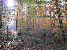
The Betzenberg is 499.5 m above sea level. NHN high mountain in Schönbuch , a mountainous forest area in the southern German Keuperbergland . It is located in the Waldenbuch district of Glashütte in the districts of Böblingen and Esslingen in Baden-Württemberg .
geography
location
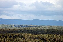
The Betzenberg rises in the Schönbuch nature park . Its summit is 1.7 km south-south-west of the small village Glashütte, a south-eastern part of the Waldenbuch north of the mountain in the Böblingen district, 4.5 km west of the village of Neuenhaus , a district of Aichtal in the Esslingen district, and 3.3 km east-north-east of the Dettenhausen municipality located in the neighboring district of Tübingen . To the south-east and south-south-east of the mountain, in the neighboring district of Reutlingen, beyond the flowing waters of Schaich , the Schaichberg ridge ( 456 m ) and federal road 27 with the villages of Häslach and Walddorf, the two parts of Walddorfhäslach (district of Reutlingen) are located.
Coming from the northeast, the border between the districts of Böblingen and Esslingen runs over the Betzenberg. It bends south on the hilltop to end in the Schaichtal on the border with the Reutlingen district. About 1.5 km west-southwest of this terminal point, below the southern flank of the mountain, in the same valley as the border of the districts of Böblingen, Reutlingen and Tübingen, there is a three-country corner .
The highest point of the Betzenberg is 1.7 km south-southwest of the village of Glashütte, which is sometimes part of the large Schönbuch clearing, from where the terrain rises to the top of the mountain. It is located directly on the Dettenhäuser Sträßle forest path .
The neighbors of the Betzenberg are - with height in meters above sea level (NHN): Uhlberg ( 469.6 m ) in the northeast, Steinenberg ( 383.1 m ; with Aichtalbrücke ) in the east, Schaichberg ( 456 m ) in the southeast, Eichenfirst ( 502 m ) in the southwest and Günzberg ( 490.5 m ) in the west.
North of the Betzenberg, the Aich , a western or left-hand Neckar tributary, flows roughly in a west-east direction through the valley of Waldenbuch, Glashütte and Neuenhaus ; the north-eastern flank of the mountain above the Aich is called Neuhauser Wand . The Aich tributary Schaich, which comes from Bromberg , runs roughly in this direction south of the mountain between Dettenhausen and Neuenhaus .
The roads around the Betzenberg include federal highway 464 in the south and the aforementioned B 27 in the southeast. From the former, state road 1208 branches off towards the northeast, which leads through Dettenhausen to Waldenbuch. There the L 1185 crosses, which runs north past Glashütte along the Aich to Neuenhaus, and shortly afterwards passes under the four-lane B 27 (1,161 m long Aichtalbrücke ). But because there are no roads leading up the mountain, it can only be reached on forest paths.
Natural allocation
The Betzenberg belongs to the natural spatial main unit group Swabian Keuper-Lias-Land (No. 10), in the main unit Schönbuch and Glemswald (104) and in the subunit Schönbuch (104.1) to the natural area Nördlicher Schönbuch (104.15). Neighboring natural spaces close to the mountains are: Walddorfer Platten (104.13) in the south and Holzgerlinger Platte (104.14) in the west.
geology
The Betzenberg lies northeast of the Bromberg Fissure, an important tectonic fault line that runs through the Schönbuch. This means that the mountain lies on the northern Schönbuchscholle, which has sunk sharply compared to the southern one. In contrast to the southern plaice, the oldest layer of the Jura , the Black Jura , has been extensively preserved on the northern part . The latter also forms the ceiling of the Betzenberg. Only below do the Keuper layers typical of Schönbuch follow . The Sheikh flowing south of the mountain cuts these layers down to the Stubensandstein , large parts of the southern slope are formed by marl .
history
On the Betzenberg there are several burial mounds and remains from the Hallstatt period and a cemetery from the Roman period .
There is also a Celtic Viereckschanze on the mountain , which is 1.8 km east-northeast of Dettenhausen near the southern edge of the Braunäcker on Dettenhäuser Sträßle . A display board on site shows: The roughly square complex is a temple area from the late Celtic period (1st century AD) enclosed by an earth wall and moat. Based on excavations in other similar entrenchments, it is known that there was a square wooden temple and deep sacrificial shafts. On the south side is a gate with a trench in front of it.
The wooded Betzenberg is part of the Schönbuch Nature Park, founded in 1972 .
On December 26, 1999, hurricane Lothar also passed through Germany. In the Schönbuch, also on the Betzenberg, he left a large windthrow behind . Subsequent bark beetle infestation exacerbated the situation. In memory of Lothar , a memorial stone was set up on the mountain around 500 m south of the wooden forest hut Weißes Häusle on the forest path Siebenbuchenwasenstrasse : On a wooden plaque mounted on the stone there is a poem by Goethe .
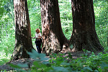

Giant sequoia trees
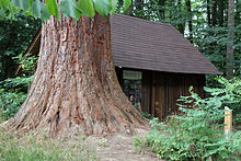
In addition to the native tree species, giant sequoia trees ( Sequoiadendron giganteum ) imported from North America grow on the Betzenberg . After this tree species had only been discovered by Europeans in 1850, King Wilhelm I had seeds brought to Europe and sown in Wilhelma . In the cold winter of 1879/80, however, most of these trees froze to death, and the few that remained were distributed among others at Betzenberg. These include three specimens that are located 1.2 km southeast of the village of Glashütte on the forest path junction of the Siebenbuchenwasenstrasse from the Dettenhäuser Weg at the Weißes Häusle forest hut . Another tree of this genus is currently the highest tree in Schönbuch at around 50 m, 2.2 km east-northeast of Johanneskirche Dettenhausen, near the southern edge of the Braunäcker orchard meadow , around 20 m from the intersection of the forest paths Dettenhäuser Weg / Einsiedlerstrasse and near the Jakob-Kayser-Steins stands.
Protected areas
The Betzenberg belongs entirely to the northeastern area of the multi-part and 112.4713 km² large fauna-flora-habitat area Schönbuch (FFH no. 7420-341). Its southern flank is part of the 467.8 km² nature reserve Schaichtal ( CDDA -Nr. 165357; NSG-Nr. 1.210), which was designated in 1995 and is characterized by lush bank vegetation, lakes and pools, rare species such as kingfisher , fire salamander and dipper and the bellied Diaper snail ( Vertigo moulisiana ) distinguishes itself . A somewhat larger area of its southern flank is part of the multi-part 153.6203 km² bird sanctuary Schönbuch (VSG no. 7420-441). On the eastern part of the mountain is the 8.96 km² protected landscape area LSG Schönbuch from December 1, 1961 (CDDA no. 324244; LSG no. 1.16.037), designated in 1961 , and 10.44 km² in its western part large nature reserve Waldenbuch / Steinenbronn (CDDA no. 325545LSG no. 1.15.083).
Betzenberg educational forest trail
On the north slope of the mountain, east of the Breitwiesen near Glashütte , is the Betzenberg educational forest trail . The educational trail with seven information boards that begins near the Burkhardtsmühle at the Scheerwässere hiking car park (accessible from the L 1185) is 3.5 km long. On the circular route you can find out about the history, geology, flora and fauna of the mountain. The path leads, among other things, along the Neuhauser Wand and to a quarry of the Stubensandstein, which made the Schaich and Aichtal valleys widely known, and passes a pond. Easily understandable texts provide information on important settlement epochs such as Hallstatt, Celts and Roman times, the high and late Middle Ages and the meaning of field names such as Mädleswiesen . A children's play area and a barbecue area provide variety. A walk on the forest nature trail takes about 1.5 to 2 hours.
Stones and wells
On and on the Betzenberg there are many old forestry department stones, memorial stones reminding of different events and several old wells. In addition to the previously mentioned memorial stone for Hurricane Lothar, there is, for example, the stone for Jak. Kayser (southern edge of the Braunäcker on Dettenhäuser Sträßle , near the sequoia there), who was killed by a fir tree there in 1919. The fountains of the mountain include: Neubrunnen (on Neuer Walddorfer Schneise above Schaichtal), Scheerwässerebrunnen (on Neuhauser Wand above Aichtal) and Stellenbrunnen (just under 750 m northeast of Weißen Häusle south of Neuhauser Wand ; with inscriptions 1905 and 1909).
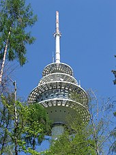
Telecommunication tower Waldenbuch
The 128.6 m high reinforced concrete telecommunications tower Waldenbuch has stood on the top of the Betzenberg since 1976 in the Neuenhaus district on the Dettenhäuser Sträßle forest path . The tower, visible from afar, is used for mobile and BOS radio .
See also
literature
- Ingrid Gamer-Wallert , Sönke Lorenz (ed.): The beautiful book: man and forest in past and present. Attempto, Tübingen 1998, ISBN 3-89308-292-1 .
Individual evidence
- ↑ a b c Map services of the Federal Agency for Nature Conservation ( information )
- ^ Friedrich Huttenlocher , Hansjörg Dongus : Geographical land survey: The natural spatial units on sheet 170 Stuttgart. Federal Institute for Regional Studies, Bad Godesberg 1949, revised 1967. → Online map (PDF; 4.0 MB)
- ^ Hermann Grees: The beautiful book as a natural space and cultural landscape. In: Wallert, Lorenz (ed.): The beautiful book: man and forest in history and present. Pp. 16–33 (see section literature )
- ^ Tourism Baden-Württemberg, Nature Park Schönbuch, the green island between Stuttgart and Tübingen ; 1st edition; procom publishing house
- ↑ State Institute for the Environment, Measurements and Nature Conservation, Baden-Württemberg ( page no longer available , search in web archives ) Info: The link was automatically marked as defective. Please check the link according to the instructions and then remove this notice.

