Uhlberg (Schönbuch)
| Uhlberg | ||
|---|---|---|
|
Lookout tower Uhlbergturm on the Uhlberg |
||
| height | 469.8 m above sea level NHN | |
| location | near Filderstadt ; Esslingen district , Baden-Württemberg ( Germany ) | |
| Mountains | Schönbuch | |
| Coordinates | 48 ° 38 '5 " N , 9 ° 12' 22" E | |
|
|
||
| rock | Keuper | |
| particularities | Uhlbergturm ( AT ) | |
The Uhlberg in the urban area of Filderstadt is 469.8 m above sea level. NHN high elevation of the Schönbuch in the Baden-Württemberg district of Esslingen . It is a popular local recreation destination, especially because of its Uhlbergturm observation tower .
geography
location
The Uhlberg is as northeastern foothills of the beautiful book , a forest area of southern German Keuper Uplands , in the conservation area Baumbachtal-Uhlberg at the edge of the Schönbuch nature reserve . It rises south of the Filderstadt districts Plattenhardt and Bonlanden and north of the Aichtal district of Neuenhaus . To the south past the mountain, the Aich flows roughly in a west-east direction , which is spanned by the Aichtalbrücke about 2 km southeast of the mountain , and to the east, roughly in a north-south direction, its tributary Baumbach . The Siebenmühlental is located about 3 km to the west-northwest .
Natural allocation
The Uhlberg belongs to the natural spatial main unit group Swabian Keuper-Lias-Land (No. 10), in the main unit Schönbuch and Glemswald (104) and in the sub-unit Schönbuch (104.1) to the natural area Nördlicher Schönbuch (104.15). Neighboring natural spaces are beyond the Baumbach: Innere Fildermulde (106.12) in the north, Harthauser Sattel (106.11) in the east and Grötzinger Platte (106.10) in the east-southeast; they all belong in the main unit Filder (106) to the subunit Schönbuchfilder (106.1).
Uhlberg Tower
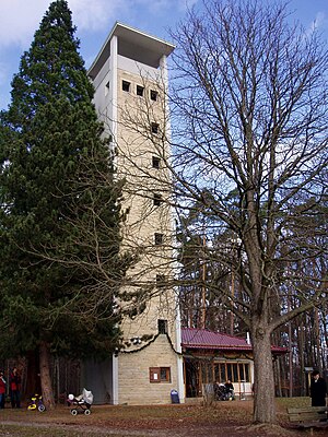
There is a clearing in the southern hilltop area of the Uhlberg . On its northern edge, at the highest point of the mountain since 1963, the 25 m high Uhlbergturm observation tower , which is only open at weekends and on public holidays, has stood.
A wooden observation scaffold was erected there as early as 1890, which was replaced in 1903 by a 17.5 m high wooden tower, which had to be demolished in 1961 due to pest infestation. In 1963, today's concrete tower was built by the Gustav Epple company according to plans by the architect Karl Hörz.
During the Second World War, the tower was also used by the military. From here you could see enemy planes from afar and give the alarm to Stuttgart in good time.
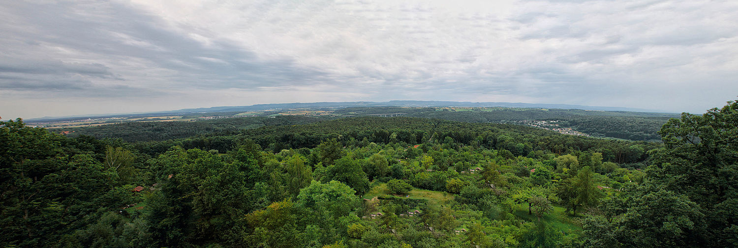
From the covered viewing platform of the Uhlberg tower you have a view of large parts of the Albtrauf - from the Plettenberg to the Hohenzollern , the Roßberg , the Hohenneuffen and the Teck to the Kaiserberge .
At the Uhlbergturm there is a kiosk with a lounge for the Swabian Alb Association, which is also only open on weekends and holidays . There is also a barbecue area there, but it is not public.
Since 2009 there has been an antenna system for the digital authority radio on the roof of the tower .
Transport links
The Uhlberg can be reached on foot on forest paths from Plattenhardt, Bonlanden and the Aichtal districts of Neuenhaus and Aich. For example, there is a parking lot for hikers on the southern outskirts of Plattenhardt on the edge of the forest on the Schlattweg side road .
Panoramic photo
See also
literature
- Nikolaus Back: 100 years of the Uhlberg Tower. In: Blätter des Schwäbischer Albverein , No. 6/2003, pp. 10–11.
Web links
Individual evidence
- ↑ a b Map services of the Federal Agency for Nature Conservation ( information )
- ^ Friedrich Huttenlocher , Hansjörg Dongus : Geographical land survey: The natural spatial units on sheet 170 Stuttgart. Federal Institute for Regional Studies, Bad Godesberg 1949, revised 1967. → Online map (PDF; 4.0 MB)
- ↑ a b Uhlbergturm… , at the Swabian Albverein, on albverein.net
- ↑ Uhlbergturm , Uhlbergturm with kiosk, on uhlbergturm.de


