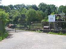
Kleinottweiler
|
Kleinottweiler
City of Bexbach
|
||
|---|---|---|
| Coordinates: 49 ° 20 ′ 52 ″ N , 7 ° 17 ′ 42 ″ E | ||
| Height : | 262 m above sea level NHN | |
| Residents : | 1085 (Jan. 1, 2020) | |
| Incorporation : | 1st January 1974 | |
| Postal code : | 66450 | |
| Area code : | 06826 | |
|
Location of Kleinottweiler in Saarland |
||
|
The Protestant Church in Kleinottweiler
|
||
Kleinottweiler is a district of Bexbach in the Saar- Palatinate district .
location
Kleinottweiler, the smallest district of Bexbach, is located in the east of the city, between Bexbach and Homburg . Another neighboring place is Jägersburg .
history
Kleinottweiler was founded as a single farm "Adewylerhof" in the Middle Ages . Nothing is known about the founder. The name was interpreted as the "hamlet of Ado". After the name changed several times over the centuries, the village became "Odweilerhof" in 1705. To distinguish it from the larger Ottweiler , the name Kleinottweiler was finally chosen.
Originally the farm belonged to the County of Saarbrücken , but changed to the newly founded County of Zweibrücken when the heirs were divided in 1182 and 1190 . It was first mentioned in documents in 1221 as "Adewilre". In the centuries that followed, the farm developed into a village thanks to its convenient transport links. Kleinottweiler was on the route from Metz to Mainz , as well as on the "Great Road from St. Wendel".
In the 16th century the counties of Nassau-Saarbrücken and Pfalz-Zweibrücken fought over ownership. On July 3, 1573, an imperial mandate was issued, which Albrecht and Philip IV reluctantly accepted. Kleinottweiler thus belonged to Pfalz-Zweibrücken and formed a joint ban and judicial district with Jägersburg . In the Thirty Years' War Kleinottweiler was completely destroyed and only at the end of the 17th century began with the resettlement.
In the 18th century, Kleinottweiler belonged to Waldmohr until it became the mayor's office in Limbach in 1824 . The village remained there until the regional and administrative reform in Saarland . On January 1, 1974, the independent municipality of Kleinottweiler , which had previously been in the Homburg district , was incorporated into the city of Bexbach . The decision was taken against the votes of the local council: the FWG - CDU working group tended towards Homburg , while the SPD parliamentary group provided for a (unrealized) unified Limbach community.
politics
coat of arms
The coat of arms was awarded to the former municipality on June 5, 1968. The oak refers to the " thick oak ", which was the symbol of the village and was mentioned as early as 1531. The tournament collar shows the former affiliation to Hattweiler (today's Jägersburg) and comes from the coat of arms of the Breder von Hohenstein .
traffic
In 1939, in the course of the Second World War, work began on building a strategic railway line from Jägersburg on the Glantalbahn via Kleinottweiler to Bexbach , in order to be able to bypass Homburg if necessary. Construction work was stopped in May 1940 without the planned route being put into operation.
Web links
- Kleinottweiler on the website of the city of Bexbach
- Literature on Kleinottweiler in the Saarland Bibliography
Individual evidence
- ↑ Bexbach: structural data, residents by district , accessed on February 2, 2020
- ↑ a b c d Bernhard Welter and Otto L. Ruffing: Bexbach. Home on the Höcherberg . Ed .: Association for local history Höcherberg. Bexbach 1999, p. 119-122 .
- ^ Federal Statistical Office (ed.): Historical municipality directory for the Federal Republic of Germany. Name, border and key number changes in municipalities, counties and administrative districts from May 27, 1970 to December 31, 1982 . W. Kohlhammer, Stuttgart / Mainz 1983, ISBN 3-17-003263-1 , p. 803 .
- ↑ Kleinottweiler. City of Bexbach, accessed on August 2, 2012 .


