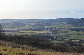
Konnefeld
|
Konnefeld
community Morschen
Coordinates: 51 ° 2 ′ 43 " N , 9 ° 37 ′ 32" E
|
|
|---|---|
| Height : | 196 m above sea level NHN |
| Area : | 4.03 km² |
| Residents : | 370 (2014) |
| Population density : | 92 inhabitants / km² |
| Incorporation : | 1st January 1974 |
| Postal code : | 34326 |
| Area code : | 05664 |
|
Konnefeld
|
|
Konnefeld is a district of the municipality of Morschen in the Schwalm-Eder district in northern Hesse .
geography
Konnefeld is in the east of the district on the foothills of the Knüllgebirge on the southwest bank of the Fulda .
history
The village was first mentioned in 1195 under the name Cunnefelt .
Territorial reform
The municipality of Morschen was formed in the course of the regional reform in Hesse on January 1, 1974 by virtue of state law through the merger of the previously independent municipalities Altmorschen, Heina, Konnefeld and Neumorschen. The municipalities of Binsförth (April 1, 1972), Eubach (July 1, 1971) and Wichte (December 31, 1971) had already been incorporated into the Altmorschen municipality . Altenmorschen became the seat of the municipal administration and local districts were set up for all former municipalities . At the same time as the merger to form the Morchen community, it changed to the newly formed Schwalm-Eder district.
Population development
Source: Historical local dictionary
| • 1585: | 57 households |
| • 1747: | 56 households |
| Konnefeld: Population from 1834 to 2014 | ||||
|---|---|---|---|---|
| year | Residents | |||
| 1834 | 457 | |||
| 1840 | 460 | |||
| 1846 | 503 | |||
| 1852 | 523 | |||
| 1858 | 462 | |||
| 1864 | 453 | |||
| 1871 | 380 | |||
| 1875 | 369 | |||
| 1885 | 353 | |||
| 1895 | 375 | |||
| 1905 | 353 | |||
| 1910 | 375 | |||
| 1925 | 374 | |||
| 1939 | 386 | |||
| 1946 | 537 | |||
| 1950 | 514 | |||
| 1956 | 442 | |||
| 1961 | 422 | |||
| 1967 | 421 | |||
| 1970 | 452 | |||
| 1985 | ? | |||
| 2000 | ? | |||
| 2014 | 370 | |||
| Data source: Historical municipality register for Hesse: The population of the municipalities from 1834 to 1967. Wiesbaden: Hessisches Statistisches Landesamt, 1968. Other sources: ;; Morschen community | ||||
Religious affiliation
Source: Historical local dictionary
| • 1885: | 353 Protestant (= 100.00%) residents |
| • 1961: | 412 Protestant (= 97.63%), 10 Catholic (= 2.37%) residents |
Historical forms of names
In historical documents, the place is documented under the following place names (the year of mention in brackets):
- Cunnefelt (1195)
- Connevelt (1220)
- Cunnenvelt (1238)
- superior et inferior Cunnevelt (1267)
- Kunfelt (1388)
- Niederkunfeld (1425)
- Connefeld [Level map of the Electorate of Hesse 1840–1861]
Web links
- Districts. In: Internet presence of the municipality of Morschen.
- Konnefeld. Local history, pictures. Local history working group Morchen
- Private local website
- Konnefeld, Schwalm-Eder district. Historical local dictionary for Hessen. In: Landesgeschichtliches Informationssystem Hessen (LAGIS).
- Search for Konnefeld in the archive portal-D of the German Digital Library
swell
- ↑ a b c d e f g Konnefeld, Schwalm-Eder district. Historical local dictionary for Hessen. (As of October 16, 2018). In: Landesgeschichtliches Informationssystem Hessen (LAGIS).
- ↑ Brief portraits of the districts. In: Internet presence. Morschen community, archived from the original on December 19, 2014 .
- ↑ Law on the reorganization of the districts Fritzlar-Homberg, Melsungen and Ziegenhain (GVBl. II 330-22) of September 28, 1973 . In: The Hessian Minister of the Interior (ed.): Law and Ordinance Gazette for the State of Hesse . 1973 No. 25 , p. 356 , §§ 14 and 27 ( online at the information system of the Hessian state parliament [PDF; 2,3 MB ]).
- ↑ a b Federal Statistical Office (ed.): Historical municipality register for the Federal Republic of Germany. Name, border and key number changes in municipalities, counties and administrative districts from May 27, 1970 to December 31, 1982 . W. Kohlhammer, Stuttgart / Mainz 1983, ISBN 3-17-003263-1 , p. 405-406 .

