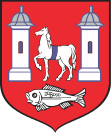
Kock (Powiat Lubartowski)
| Kock | ||
|---|---|---|

|
|
|
| Basic data | ||
| State : | Poland | |
| Voivodeship : | Lublin | |
| Powiat : | Lubartowski | |
| Gmina : | Kock | |
| Geographic location : | 51 ° 38 ' N , 22 ° 27' E | |
| Residents : | 3357 (December 31, 2016) | |
| Postal code : | 21-150 | |
| Telephone code : | (+48) 81 | |
| License plate : | LLB | |
| Economy and Transport | ||
| Street : | DK19 | |
| DK48 | ||
Kock ( German Kotzk ) is a Polish city in the powiat Lubartowski in the Lublin Voivodeship . Kock is the seat of the town-and-country municipality of the same name (gmina miejsko-wiejska). The city became known through the Kotzker Rebbe .
geography
Kock is located about 45 km north of Lublin and about 120 km southeast of Warsaw on the edge of the Pradolina Wieprza and Równina Łukowska plateau. The city lies on the western course of the Via Jagiellonica .
history
There are traces of settlement in the area of the city of Kock since 5000 BC. The present city goes back to presumably to settlements from the tenth century. In 1233 the settlement was owned by the Bishop of Płock . In 1417 Kock was granted town charter and the right to hold a market twice a year. In 1648 the city was destroyed during acts of war. In 1809 a battle took place near Kock as part of the Napoleonic Wars. Because of the participation in the January uprising , the city lost its city rights in 1870, which it got back in 1919. In 1920 there was heavy fighting during the Battle of Warsaw . Part of the city was destroyed in a fire in 1927. In early October 1939, during the attack on Poland , the battle of Kock took place .
In 1973 the Kock community was formed in its current form. From 1975 to 1998 the village belonged to the Lublin Voivodeship .
Population development

Attractions
- Parish church from 1782
- Rabinówka House - Menachem Mendel's house
- Jabłonowski Palace - Palace of Princess Anna Paulina z Sapiehów Jabłonowska built on the foundations of a palace of the Firlej family in 1770, architect: Simon Gottlieb Zug
local community
The city-and-country municipality has an area of 100.62 km². 71% of the municipal area is used for agriculture, 17% is covered with forest.
Personalities
sons and daughters of the town
- Ludwik Osiński (1775–1838) poet
Personalities who have worked on site
- Jan Firlej (1521–1574) Voivod of Cracow , reformer
- Jan Wielopolski (1630–1688) Grand Chancellor of Poland and since 1669 owner of the place
- Menachem Mendel von Kotzk (1787–1859) Hasidic rabbi died in Kotzk in 1859
- Berek Joselewicz (1764–1809) Colonel
Web links
Footnotes
- ↑ Dz.U. 1975 no 17 poz. 92 (Polish) (PDF; 802 kB)
- ^ Website of the city (accessed in Polish on September 30, 2011)
- ↑ WebCite Główny Urząd Statystyczny, "LUDNOŚĆ - STAN I STRUKTURA W PRZEKROJU TERYTORIALNYM", as of December 31, 2008 ( Memento from June 3, 2009 on WebCite )
- ↑ WebCite Główny Urząd Statystyczny, "LUDNOŚĆ - STAN I STRUKTURA W PRZEKROJU TERYTORIALNYM", as of December 31, 2010 ( Memento from June 15, 2011 on WebCite )
- ↑ regioset.pl (Polish / English accessed on October 2, 2011)


