
Krottenbachstrasse (Vienna)
| Krottenbachstrasse | |
|---|---|
|
|
|
 |
|
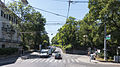
| Krottenbachstrasse at Cottagegasse | |
| Basic data | |
| place | Vienna |
| District | Dobling |
| Hist. Names | Neustiftgasse |
| Connecting roads | West end: Rathstrasse, Agnesgasse |
| Cross streets | Cottagegasse, Obkirchergasse, Friedlgasse, Görgengasse, Börnergasse, Felix-Dahn-Straße, Glanzinggasse, Strehlgasse, Zuckerkandlgasse (selection) |
| Technical specifications | |
| Street length | approx. 3.39 km |
The Krottenbachstraße is a street in the 19th district of Vienna Döbling . It provides the main connection from Oberdöbling to the Heurigen villages Salmannsdorf and Neustift am Walde . It was therefore called Neustiftgasse until 1894 . The current name refers to the vaulted Krottenbach since 1908 , whose valley the road follows.
It branches off at a right angle from Billrothstrasse and leads first in an approximately westerly and later in a northwesterly direction to the outskirts of Neustift am Walde, where Agnesgasse (to Sievering ) branches off from Rathstrasse (to Neustift am Walde and Salmannsdorf) . It first crosses Oberdöbling and then forms the border between Unter- and Obersievering in the north and Währing, Pötzleinsdorf and Neustift am Walde in the south of the road.
Street history

Initially, the street was of little importance, as it ended before the entrance to Neustift am Walde and the subsequent Rathstraße was not developed for traffic. There was hardly any settlement, the Chlaitzing and Rohrigenwiesen settlements in the Krottenbachtal had not existed since the Middle Ages . Salmannsdorf and Neustift were developed from Pötzleinsdorf .
With the exception of a few Biedermeier houses, development on Krottenbachstrasse did not begin until the end of the 19th century and the beginning of the 20th century . A number of factory buildings on the street date from this time , for example Danubia AG for gas works, lighting and measuring equipment, which was demolished a few years ago for a residential complex. However, it is mainly characterized by residential buildings from the post-war period . Sometimes there are still allotments and vineyards today .
At the end of the 19th century , the Krottenbach was canalized as there were repeated heavy floods and the stream itself had degenerated into a rubbish canal. At the beginning of the 20th century , Rathstrasse could therefore be expanded, whereby the importance of Krottenbachstrasse increased rapidly and replaced the steep road from Pötzleinsdorf as the main traffic artery to Neustift and Salmannsdorf. This ultimately also led to these two places being separated from Währing in 1938 and becoming part of Döbling.
Buildings
- District court Döbling: This building on the so-called Hirschenbergl was originally built as a private villa for the banker Adam Adalbert von Henikstein on a property inherited in 1784. The doctor Bruno Görgen set up a psychiatric clinic here in 1831 , which at that time was still called an "insane asylum". During the First World War the building served as a hospital . The district court has been located here since 1991. The house has its main entrance in Obersteinergasse and is difficult to see from Krottenbachstrasse.
- Stop Wien Krottenbachstraße the Vienna suburbs line : Because of the sparse settlement there was originally not stop here. The increasing development, however, meant that a station was built on the occasion of the reopening in 1987. The architects Alois Machatschek and Wilfried Schermann based themselves on Otto Wagner's conception.
- Glanzinger parish church : built from 1969 to 1970 by Josef Lackner .
- Glanzing settlement: This cooperative settlement was founded in 1921 by employees of the municipal electricity works under the name Alt-Glanzing , which brought the name of Chlaitzing back to life . It was laid out according to plans by the architects Hugo Mayer and Albert Tichy by the Vienna City Building Office with 158 plots. The first development plan is said to come from Adolf Loos , but has been lost. On behalf of the Altmannsdorf-Hetzendorf cooperative , Hugo Mayer expanded the estate by 108 parcels in 1923.
- Öllerer-Kreuz: This wayside shrine marked the old municipal boundaries between Neustift and Pötzleinsdorf. It contains a Madonna figure and votive pictures .
Parks
- Fellingerpark: This green area on the Hirschenbergl was created in 1986 and named after the doctor Karl Fellinger in 2001 .
- Hugo Wolf Park: The park was built in 1924 on the steep slope of a former sand pit , and a children's outdoor pool was also created. Until 1953 it was called Hartäckerpark, then it was named after the composer Hugo Wolf . In 1930 Franz Waldmüller created the bronze sculpture Little Brother and Sister here .
traffic

In addition to its development function, Krottenbachstrasse also serves as an important access road to Vienna's Höhenstrasse .
A tram line was licensed here as early as 1899 , but it was never built for financial reasons, although the local council made several urgent demands for it. When the trackless railway from Pötzleinsdorf – Salmannsdorf failed, there were frequent replacement buses here. On January 30, 1928, however, the municipality of Vienna finally put a bus route through Krottenbachstrasse into operation. This line was the municipality's first peripheral bus line (after short-lived attempts at the beginning of the century) and was temporarily operated without a line signal. On October 17, 1935, it received signal 20. During the Second World War there were restrictions. However, since the traffic had to be maintained because of the war-important operations, it was decided to build a trolleybus line, which, however, could only start operating after the war on October 9, 1946 with the line designation 22 . It was the only modern trolleybus line in Vienna. This special case also led to the discontinuation on December 3, 1958. The replacement bus line was designated as 39A from March 27, 1961 and, from April 29, 1972, was incorporated into bus line 35A , which still operates there today.
gallery
The beginning of the street at Bilrothstrasse

At the underpass of the S45 S-Bahn

At No. 46

At the Rodlergasse, on the left the Hugo-Wolf-Park

At Gustav-Pick-Gasse

At Siolygasse

At No. 223

At Strehlgasse

The end of Krottenbachstrasse at Zuckerkandlgasse


literature
- Weihsmann, Helmut: The Red Vienna . Social democratic architecture and local politics 1919–1934. Vienna 2002, ISBN 3-85371-181-2 .
- Dehio-Handbuch Wien X. to XIX. and XXI. to XXIII. District. Verlag Anton Schroll, Vienna 1996, ISBN 3-7031-0693-X .
- Kretschmer, Helmut: Viennese district culture guide XIX Döbling. Verlag Jugend & Volk, Vienna 1982, ISBN 3-7141-6235-6 .
- Czeike Felix (Ed.): Historisches Lexikon Wien, Volume 3. Kremayr & Scheriau, Vienna 2004, ISBN 3-218-00744-5 .
Web links
Coordinates: 48 ° 14 ′ 25 ″ N , 16 ° 20 ′ 27 ″ E