Loermcke
| Loermcke | ||
|
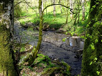
The Lörmecke in the NSG Lörmecketal , municipal boundary between Warstein and Rüthen |
||
| Data | ||
| Water code | DE : 276226 | |
| location | North Rhine-Westphalia , Germany | |
| River system | Rhine | |
| Drain over | Glenne → Möhne → Ruhr → Rhine → North Sea | |
| source | South of Warstein at Warsteiner Kopf 51 ° 23 ′ 51 ″ N , 8 ° 21 ′ 12 ″ E |
|
| Source height | 542 m above sea level NN | |
| muzzle | At Suttrop in the Glenne coordinates: 51 ° 27 '54 " N , 8 ° 23' 31" E 51 ° 27 '54 " N , 8 ° 23' 31" E |
|
| Mouth height | 284 m above sea level NN | |
| Height difference | 258 m | |
| Bottom slope | 21 ‰ | |
| length | 12.5 km | |
| Catchment area | 17.89 km² | |
The Lörmecke is a 12.5 km long, south-westerly or orographically left-hand tributary of the Glenne in the Arnsberg Forest Nature Park in the Soest and Hochsauerlandkreis (HSK) district in North Rhine-Westphalia , Germany .
course
The Lörmecke rises in the Warsteiner Forest, the eastern part of the Arnsberg Forest Nature Park . Its source is located about 500 m east-northeast of the highest elevation of this nature park or the highest point of the urban area belonging to Warstein between Warstein in the north and Bestwig in the southeast or north of Meschede - Eversberg .
The Lörmecke initially flows east-southeast. After 800 m, a stream of about the same size flows into the Lörmecke at the ford ( 489 m above sea level ) of the former Kriegerweg ; for the first 3.3 km it forms the border of the circles mentioned above. In the further course the brook flows in the district of Soest in a northeast direction, while the Lörmecke has cut into the mountains more than 100 m deep. After 5 km the main direction of the river changes to the north. After a river kilometer 6.5 km, the Lörmecke leaves the closed forest and flows through the Warsteiner mass limestone, with the special features of the Hohler Stein cave and Lörmeckewasserwerk.
After around 11 kilometers flow path that is opening the Lörmecke in coming from the east Möhne influx Glenne reached. It is located around 1.5 km northeast of the center of Suttrop , a district of Warstein, on a bridge on the "L 735" state road .
Catchment area
The Lörmecke has a catchment area of 17.89 km² .
Protection expulsions
The entire course of the river from the source to the confluence is designated as an FFH area and a nature reserve (NSG) at the same time . The entire course of the river is in the FFH area Lörmecketal (DE-4516-301). In contrast, the course of the river is in three different nature reserves. The source and a small part of the upper course is in the urban area of Meschede (HSK) as a nature reserve Lörmecketal (Meschede) . Another part of the upper reaches of the Lörmecke in the municipality of Bestwig (HSK) is designated as the Lörmeckal system nature reserve. In the Soest district, the rest of the river is in the Lörmecketal nature reserve (Soest district) .
Worth seeing
In addition to the wooded landscape of the Arnsberg Forest Nature Park, the Lörmecke Tower to the west of the Lörmecke spring is worth seeing and visiting, the one in the Warsteiner Forest next to the highest point in Warstein or near the highest point of the Arnsberg Forest as a viewing opportunity in the Sauerland serves.
Individual evidence
- ↑ a b German basic map 1: 5000
- ↑ a b Topographical Information Management, Cologne District Government, Department GEObasis NRW ( Notes )
Web links
- Lörmecketal , natural treasures of South Westphalia


