
Luessbach
| Luessbach | ||
 Lüßbach in Starnberg |
||
| Data | ||
| Water code | DE : 16464 | |
| location | Europe , Germany , Bavaria | |
| River system | Danube | |
| Drain over | Starnberger See → Würm → Amper → Isar → Danube → Black Sea | |
| origin | near Haidach (municipality of Eurasburg ) 47 ° 51 ′ 30 ″ N , 11 ° 23 ′ 19 ″ E |
|
| Source height | 698 m above sea level NHN | |
| muzzle |
Starnberger See near Starnberg Coordinates: 47 ° 59 '47 " N , 11 ° 21' 26" E 47 ° 59 '47 " N , 11 ° 21' 26" E
|
|
| length | 21 km | |
| Outflow at the Percha gauge |
NNQ MQ MHQ |
84 l / s 325 l / s 3.28 m³ / s |
| Left tributaries | Biberkorbach , Halsbach | |
| Right tributaries | Mühlbrunnenbach | |
| Medium-sized cities | Starnberg | |
The Lüßbach is after Ostersee-Oh and George Bach ( Maisinger Bach ) is the third largest inflows in the Lake Starnberg . On average, it feeds around 9 percent of the total inflow. The area of its catchment area is around 52 km², about 16 percent of the total catchment area of Lake Starnberg. The Lüßbach drains a depression between Lake Starnberg and the Isar or Loisach , which is framed in the west and east by the lateral moraines of the glacier tongues of the Isar-Loisach glacier from the Worms ' Age.
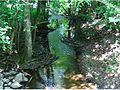
The Lüßbach rises from a pond near the Haidach district of the municipality of Eurasburg and initially flows through wetlands and meadow areas. It is dammed in the Sonderhamer and Degerndorfer Weiher . On its course to the north it flows through the municipal areas of Münsing and Berg (districts of Höhenrain, Bachhausen, Farchach). At the height of Kempfenhausen, the Lüßbach breaks through the eastern lateral moraine of Lake Starnberg in the Manthal. Finally it flows into the Starnberg Lake in the Starnberg district of Percha. 100 meters above the mouth there is a water level station from the Weilheim water management office .


Sonderhamer Weiher on the upper reaches of the Lüßbach, in the background the Benediktenwand

Lüßbach in Münsing

Lüßbach approx. 2 km north of Münsing
Lüßbach im Manthal

Gauge station in Starnberg-Percha

The Lüßbach flows into the Starnberger See


