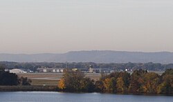
La Crosse Regional Airport
| La Crosse Regional Airport | |
|---|---|

|
|
| Characteristics | |
| ICAO code | KLSE |
| IATA code | LSE |
| Coordinates | |
| Height above MSL | 200 m (656 ft ) |
| Transport links | |
| Distance from the city center | 11 km north of La Crosse (Downtown) |
| Street | Airport Road |
| Basic data | |
| opening | 1935 |
| operator | City of La Crosse |
| surface | 558 ha |
| Terminals | 1 |
| Passengers | 102,958 (2012) |
| Flight movements |
72 per day |
| Runways | |
| 18/36 | 2665 m × 46 m concrete |
| 13/31 | 1844 m × 46 m asphalt |
| 3/21 | 1585 m × 46 m asphalt |
The La Crosse Regional Airport , until August 2013: La Crosse Municipal Airport ( IATA : LSE , ICAO : KLSE ) is the airport of La Crosse in La Crosse County in the west of the US state Wisconsin . The continuously open airport connects the Mississippi region in Wisconsin, Minnesota and Iowa to the air traffic of the country via feeder flights to major airports.
The Federal Aviation Administration (FAA) classifies the airport, which is part of the National Plan of Integrated Airport Systems, as a non hub primary commercial service airport based on the number of 111,462 departing passengers .
location
The airport is located in the north of French Island , an island in the Mississippi in the north of the metropolitan area. Airport Road and Lakeshore Drive connect to downtown La Crosse and Dawson Avenue to Interstate 90 .
Furnishing
The airport has three runways, each with a concrete or asphalt surface. The airport control tower was on the list of facilities to be closed in the 2013 budget dispute in the US in 2013.
There is a passenger terminal with 3 passenger boarding bridges and a baggage handling system . Several rental car companies have bases in the reception building.
Airplanes and aircraft movements
A total of 85 aircraft are stationed at the airport. Of these, 73 are single-engine and 4 multi-engine fan guns, 7 jet jets and 1 helicopter.
Of the 72 flight movements per day, 1 percent can be assigned to scheduled and charter traffic , 57 percent to general aviation and 30 percent to air taxi traffic. There are also around 11 percent military aircraft movements.
Airlines and destinations
- American Eagle - Chicago O'Hare , Des Moines
- Delta Connection - operated by Endeavor Air - Detroit , Minneapolis-Saint Paul
- Delta Connection - operated by SkyWest Airlines - Minneapolis-Saint Paul
Web links
- Official website
- AirNav.com - La Crosse Regional Airport
- FAA Airport Information - KLSE
- Flight Aware - Live Flight Tracker
Individual evidence
- ↑ Passenger Boarding (Enplanement) and All-Cargo Data for US Airports Retrieved on December 30, 2013
- ↑ List of NPIAS Airports with 5-Year Forecast Activity and Development Cost (PDF; 2.1 MB) ( Memento from September 27, 2012 in the Internet Archive ). Accessed December 30, 2013
- ↑ AirNav.com - KLSE Retrieved on December 30, 2013
